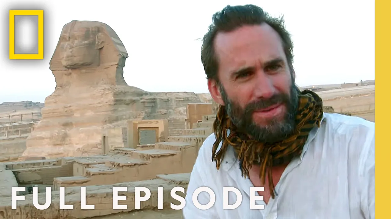
Secret Sunken Cities (Full Episode) | Drain the Oceans Compilations | National Geographic
Chapters9
Introduction to the fascination with sunken sites and the question of Atlantis and other submerged places.
Drain the Oceans reveals sunken cities like Pavlopetri, Baiae, and Alexandria’s Pharos, using draining-and-scanning tech to rethink ancient history and even test Atlantis’ location.
Summary
National Geographic’s episode makes a bold case that underwater exploration can rewrite big chapters of human history. Patrick, Jon, and their teams walk us through Pavlopetri, a Bronze Age town in Greece, showing it as the oldest submerged town and detailing 2,400 years of occupation including olive oil storage and loom weights. They then haunt Baiae, the Roman “sin city” at Napoli’s bay, where a volcanic crater landscape explains why so much of the luxury town lies submerged today. The Pharos of Alexandria comes under the lens next, with Isabelle Hairy leading a photogrammetry-driven reconstruction that pieces together a 41-foot-deep doorframe and granite blocks to reimagine the lighthouse’s three-tier design and a possible door. The ancient Atlantis mystery is revisited in the Straits of Gibraltar, where Marc Gutscher uses ROV surveys and drainage visualization to test Plato’s tale against geology and the absence of built ruins. Across these stories, science-driven visuals drain waters, map seabeds, and stitch together fragments from museums to offer a clearer view of what ancient sites looked like and why they vanished. The episode argues that the future of archaeology lies in mapping, modeling, and reinterpreting submerged evidence rather than relying on dusty legends. Throughout, the narrative contrasts myth with measurable data, showing how tides of technology can resurrect civilizations once swallowed by the sea.
Key Takeaways
- Pavlopetri—evidence of a Bronze Age town occupies ~20 acres and could have housed about 4,000 people, with continuous occupation from ~5500 BCE to ~1100 BCE as shown by uninterrupted pottery sequences.
- The Pavlopetri excavation used underwater scanning to map foundations and streets, revealing a planned town with a central market-like open area and civic buildings.
- Baiae’s ruins lie in a volcanic cradle within Campi Flegrei, where 24 volcanoes over 38 square miles and hot-water vents explain why extensive urban areas sank beneath the bay.
- Pharos reconstruction hinges on photogrammetry and 50,000 underwater photos over 28 weeks, enabling researchers to drain the harbor’s waters and identify 3,000 granite blocks, door frames, and a 41-foot-high doorway.
- The search for Atlantis in the Straits of Gibraltar uses ROV mapping and sonar to test Plato’s geography, finding no submerged city but recognizing evidence of Stone Age coastal occupation and the plausibility of earthquakes and tsunamis in Atlantis’ destruction.
- Isabelle Hairy’s door-frame reconstruction provides the strongest physical clue to the Pharos’ original entrance and its three-tower plan.
- The episode argues that many ancient “wonders” survived in part because of enduring myths; science-based drainage and 3D modeling can bring some of these legends into verifiable focus.
Who Is This For?
Essential viewing for archaeology enthusiasts and history buffs curious about how modern scanning and photogrammetry reshape our understanding of submerged civilizations and the fate of the Pharos, Pavlopetri, and Baiae.
Notable Quotes
"There is a huge amount of unrecorded human history beneath the ocean's surface that we don't know very much about at all."
—Patrick frames the episode’s premise about submerged civilizations.
"Pavlopetri is one of the most important Bronze age sites in the world... and the oldest submerged town ever discovered."
—Jon introduces Pavlopetri’s significance and age.
"Draining the site has enabled us to see the lighthouse. We've even found blocks that might have formed the corner stones, but no blocks found underwater indicated the walls sloped. The walls were straight."
—Isabelle Hairy on reconstructing Pharos’ doorway and geometry.
"This is a 41-foot high doorway and weighs more than 200 tons!"
—Isabelle describing the Pharos doorway reconstruction.
"Atlantis did not exist in the tiny island of Spartel. If it did exist traces of it have not yet been found."
—Marc Gutscher clarifies Atlantis location and evidence.
Questions This Video Answers
- How did Pavlopetri become the oldest submerged town and what does its layout reveal?
- What evidence do scientists use to reconstruct the Pharos lighthouse underwater?
- How do underwater volcanoes in the Bay of Baiae explain the city’s submersion?
- Can photogrammetry recreate ancient monuments like the Pharos of Alexandria from submerged blocks?
- Where could Plato’s Atlantis have been located, and what evidence supports or refutes it?
National GeographicDrain the OceansPavlopetriBaiaePharos of AlexandriaAlexandria LighthouseAtlantisRemotely Operated Vehicle (ROV)PhotogrammetryCampi Flegri (Fields of Fire)
Full Transcript
NARRATOR: Lost civilizations. Mysterious sunken cities. And legendary Atlantis itself. Vanished beneath the waves. PATRICK: There is a huge amount of unrecorded human history beneath the ocean's surface that we don't know very much about at all. NARRATOR: Are these just rocks, or the remains of an ancient city? JON: Parts of this are just beginning to be revealed for the first time. Wow. NARRATOR: Can scientists solve the mystery of Alexandria's Lighthouse and recreate one of the ancient wonders of the World? And is the real site of Atlantis finally about to be revealed? PATRICK: People want to believe in places like Atlantis.
They want to believe in other worlds. (theme music plays) NARRATOR: Stories of sunken cities have fascinated for millennia. The most tantalizing of all: Atlantis. First described by ancient philosopher, Plato, a dazzling civilization destroyed by the gods as punishment for human pride. JON: People connect to that story, and it's because of this idea of an ancient civilization, a utopia, that we've evolved from. NARRATOR: 2,000 years later, the idea of Atlantis continues to fascinate A-list archaeologists. And the producers of B-list movies. NARRATOR (over film): Atlantis is the story of those who, like today, would use the marvels of science to conquer and enslave.
Atlantis, a world that worships strange gods of science, of science gone berserk... PATRICK: Plato would have loved this okay? He would have had a great time. He would have said, 'at last, you know, people are listening to me. People are taking my story seriously.' And he would have enjoyed this immensely. NARRATOR: Using science, not science fiction, draining the oceans exposes new evidence about Atlantis. And other stories of great sunken cities, around the world. As the waters around Greece drain away, an extraordinary underwater vista is exposed. Could these patterns on the sea floor be remnants The village of Elafonisos sits on a small island just off the Greek coast.
At first glance, an ordinary fishing port. But in 1967, less than 100 yards out to sea, something attracts the attention of a visiting maritime archaeologist. Snorkeling in 13 feet of water, Nicholas Fleming catches a glimpse of regular shapes on the sea floor. Then, exploring deeper, he sees what he thinks is evidence of human activity. FLEMING: I looked at these rows of stones, and I just had no idea what it was, but I realized immediately that it was manmade, that we were looking at a large part of a town, and I mean I just went crazy.
NARRATOR: Fleming is convinced he has found something special. But could these simply be natural formations, mimicking human structures. The following year, Fleming returns with a team of surveyors to discover the truth. Using tape measures, they document what they find. And the results are astonishing. The site is strewn with signs of human activity. Pots, storage vessels and tools lie across a huge area of the sea bed. There can be no doubt: Fleming has discovered the remains of an ancient town. It's named Pavlopetri after a nearby island. But who built it, and when? These questions inspire a generation of archaeologists.
JON: Well I've always been interested in submerged settlement, submerged towns, and I'd read about Pavlopetri as a boy. And this idea of an intact, prehistoric town underwater just seemed you know incredibly romantic, incredibly exciting. NARRATOR: Henderson can now fulfil a childhood dream and explore this haunted underwater world for himself. JON: Here we have a quern stone. You can see it's got a very concave, concave surface there. That's for grinding grain or whatever it was that you were turning into you know flour. That's quite a clear artifact. Very nice. There is a huge amphora. One, amphora, two amphora, three, four, five.
This gives you an example of what's coming out of the sand, what's eroding out of the sand. Look, there's the base of an amphora, there's the amphora shape there, it's on its side. There's another one next to it and another one there. NARRATOR: And further into the bay, more evidence of human life, and death. JON: So, here's a cist grave. Edge set slabs. A very small one. Possibly for a baby. There are about 40 of these on the site. NARRATOR: Diving gives intriguing glimpses of objects lying upon the sea bed. But it's impossible to gain a complete picture.
To do this, it must be mapped with the latest in underwater scanning technology. Using this data, it's now possible to drain away the waters above Pavlopetri... and bring sunlight back to a forgotten world... and a true Sunken City. With the entire bay drained away, everything becomes clear. The lines are the foundations of buildings, laid out in clear streets. At the heart of the town is a large open area, perhaps an ancient market place. And nearby, the remnants of a huge structure, perhaps an important civic building. The remains cover 20 acres and the town could have housed 4,000 people.
A thriving, ancient settlement once existed here. The next challenge is to discover who built it. And when. JON: We know how old the occupation of the site is, because we've got pottery. And pottery particularly in this part of the world is very well dated. What was really exciting is we actually found evidence of pottery from the end of the Stone Age. So, we've actually got occupation here from about 5,500 years ago. And then we've got every single bit of pottery you would expect up until about 1100 BC. There's no gaps in that. So, the place seems to have been continuously occupied throughout the Bronze Age.
NARRATOR: Pavlopetri was occupied for 2,400 years during a revolutionary period of human development. At its peak in the Bronze Age, around 1700BC, it looked like this: a perfect example of the time when Europeans start to live in stone-built towns with regular laid out streets. But one question remains. Why did the builders of this town choose this particular location, in a remote part of ancient Greece? Exploring the drained landscape around the ancient city reveals an all-important clue. At its edge, a huge sand bank stretches out into the ocean. During the Bronze Age, people don't build ports out of stone.
They bring ships up to the shore and then beach them. And Pavlopetri's location means it can exploit the trade routes that boom during the Bronze Age across the Mediterranean. Evidence of early commercial activity is everywhere. JON: The interesting thing is we've clearly got a lot of material coming in. We found thousands and thousands of shards of very large storage vessels, which have been used for storing olive oil, wine, that kind of thing and generally anything. They were like the containers of the day. NARRATOR: And that's not all. Pavlopetri is also a hub for manufacturing. JON: We've got a lot of evidence for loom weights, thousands of loom weights, way more than you would need for domestic production so it seems that maybe textiles were something that were being produced on the site and perhaps exported.
NARRATOR: Pavlopetri is an extraordinary, bustling, vibrant port city. And an important center of trade. So how did such an advanced metropolis meet its end? NARRATOR: An ancient, submerged city off the coast of Greece. How it came to lie on the sea floor is a mystery. JON: One of the interesting things about Pavlopetri and its submergence is that there are no historical references to it at all. It sunk under the waves and then it was out of sight, out of mind. And there's certainly no classical sources that refer to its sinking. And there's nothing until it's discovery really in the twentieth century.
NARRATOR: Scanning the drained bay could reveal what happened to Pavlopetri. At the edge of the town, it's possible to make out three mysterious lines. These are strips of beach rock, formed by the action of sunlight on salt water. They only form near the shoreline. It can mean only one thing: earthquakes caused this land to subside into the sea. JON: So, there was a big earthquake, perhaps part of the remains went under the water, part of them are still surviving, then there was another earthquake it was pushed under then there was a third, and it was gone.
NARRATOR: Pavlopetri is one of the most important Bronze age sites in the world... and the oldest submerged town ever discovered. But it's not alone. JON: A lot of the major finds in the next couple of decades are going to come from the sea. I think we have the potential to rewrite what we know about human history. NARRATOR: 2,000 years ago Rome has grown far beyond its Italian homeland. Its legions control a vast area from North Africa to Northern Europe. From Spain to the Black Sea and the Roman Navy dominates the Mediterranean from its port next to the city of 'Baiae' in the shadow of mighty Vesuvius.
Baiea earns a reputation as the 'Sin City' of Ancient Rome. It's famous for debauchery and excess. But what really went on in this seaside party town? And why does so much of it lie abandoned beneath the waves? Jon Henderson is exploring the secrets of this sunken city. Starting with the huge harbor walls that once surrounded the city's port. JON: These are built by the Romans. They were incredible engineers. You can still see the artificial construction of this very clearly. You can see the brickwork, overlapping bricks. Amazing. NARRATOR: Beyond the port walls lie magnificent villas where Roman Emperors host lavish parties.
JON: Look at this. This is a mosaic floor of the one of the bath houses. Looks like it was just done yesterday. It's phenomenal! Absolutely amazing! This is called the Nymphaeum. It's actually an elaborate dining room for the Emperor Claudius. You can imagine people eating food surrounded by these water nymphs. It was built to entertain the Emperor's most honored guests. Well one of the things I'm interested in is actually the scale of the site. Much of the focus has been on the resort area of Baiea itself. But on the margins of the site there are constantly new areas coming up.
That's it, slow it down. There's a lot down there. NARRATOR: So why did the Romans lavish so much wealth on building a pleasure city here? JON: The Romans came to Baiae because of the lovely maritime climate and the thermal springs. But Baiea was also a very important port, it's a natural port, it's one of the best ports on the western coast of Italy at the time. NARRATOR: Wealth brought pleasure and excess to this Las Vegas of the Roman World. JON: There were parties, there was drinking, it was a place to get prostitutes and writers at the time referred to it as "a harbor of vice" or "a vortex of luxury".
NARRATOR: The famous Roman philosopher, Seneca is appalled by what he finds. SENECA: Baiae is a place to be avoided. People wandering drunk along the beach, the riotous reveling of sailing parties, the lakes noisy with singing. NARRATOR: But time is running out for this party-town. Gradually many of its most impressive public buildings and private villas are lost beneath the waves. What happened? Based on detailed sonar scanning, draining away the Mediterranean begins to reveal the real story of the rise and fall of Baiae. It exposes just how much of the city fell under the waves. 430 acres of streets, shops, warehouses, and luxury villas.
Draining beyond the town uncovers the reason... an extraordinary landscape, shaped by powerful underground forces. The whole town sits inside the shallow crater of a giant volcano. JON: You hear about Naples, people talk about Vesuvius. They don't seem to realize that the whole western Bay of Naples itself is a massive volcano... We're actually standing in a volcano now. NARRATOR: The people of Baiae may not understand the unpredictable forces stirring beneath them. DOUGAL: And we know we're sat on a volcano. But it's not your normal volcano. It's this much larger and much more complex volcanic system. NARRATOR: There's remarkable evidence of its restless power three miles away, across the bay in the 'Temple of Serapis'.
DOUGAL: It's really when you get into the Roman ruins that you can see what's going on. You have to look closely though, if you look up at the column behind me you'll see in the middle part it's got this strange texture to it. Lots and lots of holes in it. There's even bits of shell on this. This is a stone boring marine mollusk. That tells me that this stuff has been under the sea. NARRATOR: Can draining the waters of the Bay even further explain why the Romans lost their 'Sin City'. NARRATOR: Baiae, once a major Roman port, lies half-submerged amid a volcanic landscape.
Jon Henderson has been exploring the area beneath the waves and he finds a tell tale sign of the power at work here. JON: So we've got all these bubbles are coming out of the ground, all this hot air coming up from the sea bed. You really get a sense here of the power that's underneath, waiting to burst out. Hot water piling out of the ground under the sea. I've never seen anything like this. NARRATOR: These underwater vents are superheated by molten rock from the volcano below, evidence that the forces stirring under Baiae are highly active.
Locals call the area 'Campi Flegri'... the 'Fields of Fire'. Now, for the first time, draining the water from the entire bay exposes an extraordinary sight. 24 separate volcanoes nesting inside the crater. It spans an incredible 38 square miles. But geologists here have been mapping deep inside the earth itself. Now draining not only the Mediterranean but looking deep into the layers of rock below it, reveals a fantastical sight. Giant cauldrons of super-heated molten rock, known as a 'magma chambers' that slowly empty and fill over centuries. Evidence that this huge volcanic system is still very much alive.
JON: Basically you've got magma chambers sitting under the sea which operate almost like bellows, when they fill full of lava the ground goes up, and then when they empty again the ground goes down and this process is going on constantly. NARRATOR: It's as if the land within the Campi Flegri crater itself is 'breathing'. The damage caused by these breathing chambers of magna coincides with the decline of the Roman Empire. As part of the city slides beneath the Mediterranean, the population shrinks and the parties end... sin city is no more. Centuries before the Roman Empire... A great civilization dominates part of the Mediterranean.
Ancient Egypt... It lasts for 3,000 years. Its people develop a remarkable written language using pictures and symbols. They worship strange gods. And they build two of the seven wonders of the ancient world. The first, the great pyramids of Giza. ROBERT: The ancients determined the seven wonders because they met certain criteria. It is the ingenuity of the design, but it had to be built on a super colossal, over the top scale. NARRATOR: The Egyptians' second ancient wonder is the lighthouse of Alexandria. Known as the Pharos, it is built on a grand scale like the other wonders: the Hanging Gardens of Babylon and the Colossus of Rhodes.
Of the seven wonders, only the pyramids now survive. But as the waters of the Nile Delta drain away... can the architectural marvel of the Pharos be brought back to life from the seas around Alexandria Harbor and recreated accurately for the first time a sight that once dazzled the world. ROBERT: The Pharos ranked as one of the seven wonders of the ancient world because it was something that had never been seen before. NARRATOR: Built in the third Century BC, Alexandria's lighthouse is a technological and architectural masterpiece. Egypt's new rulers want the Pharos to send a big and simple message.
EMAD: they wanted to show how powerful is the city. So you'd need a sign, a big huge banner that says welcome to Alexandria. The Pharos was created mainly as a landmark. NARRATOR: But once Egypt's power has faded, Alexandria's famous lighthouse falls into disrepair. The land beneath it slowly subsides into the sea, and in the 14th Century it finally collapses after it's struck by an earthquake. The Pharos is thought to be lost here beneath 20 feet of water at the entrance of Alexandria harbor... can science help rediscover this sunken wonder? NARRATOR: A French team of archaeologists is trying to rediscover the Pharos true magnificence.
Using the latest undersea imaging technology, they're scouring the seabed for clues. Their aim is to digitally rebuild this lost Ancient Wonder of the World, Leading the investigation is architect and archaeologist Isabelle Hairy. Isabelle's task is to unlock the true dimension and design of the Pharos. But her job is made harder by the wildly conflicting accounts of what it actually looked like. ISABELLE: We came across these quite extraordinary images of the lighthouse. NARRATOR: Different impressions from past travelers and artists shroud the true appearance of the lighthouse in mystery. ISABELLE: It's depicted here as the Tower of Babylon.
Here a very classical building with floors one above the other, with doors opening into mysterious rooms. NARRATOR: Where does the truth lie? Will the underwater granite blocks provide answers? To find out, Isabelle's team uses a technique called photogrammetry... capturing thousands of detailed images across the enormous site. -We have a closer view here on the map. This is block 1003. ISABELLE: Do you think we can go further, we can go more on the North? NARRATOR: After 28 weeks of diving and with 50,000 photographs, Isabelle has the data she needs to finally unlock the secrets of the Pharos.
Combining this unique data with cutting edge computer graphics means that for the first time the waters around Alexandria harbor can be drained away. As the Mediterranean begins to empty, surprising shapes come into view. Nearly 3,000 granite blocks scattered across three acres of the seabed. These are not natural rock formations - but clearly the work of human hands. Statue bases... chunks of pillars. All from a building of monumental proportions. The drowned ruins of a genuine ancient wonder... The Pharos lighthouse. Brought back into the light of day for the first time in 600 years. Already Isabelle's work has delivered one revelation.
Some of the blocks from the drained landscape are a crucial clue to the shape of the Pharos. ISABELLE: Draining the site has enabled us to see the lighthouse. We've even found blocks that might have formed the corner stones, but no blocks found underwater indicated the walls sloped. The walls were straight. NARRATOR: This is the first physical proof of the lighthouse's design. A huge advance on all previous knowledge. But piecing together the rest of the underwater jigsaw remains an enormous challenge. EMAD: What we have is a puzzle, basically it's a 3,000 pieces puzzle that you have to try to fit things together.
Will it fit or will it not fit? NARRATOR: And what's more, some crucial parts of the puzzle are missing... taken to museums by previous excavations. But one important piece lies nearby, abandoned on the quayside. ISABELLE: This was probably the greatest discovery, found on the site. NARRATOR: But what is it? ISABELLE: So, here we have a side part of a door frame. We know because this is the place where the door would have been fixed. NARRATOR: This groove is carefully carved as the frame for a gigantic door. And incredibly, Isabelle can match the frame's distinctive shape to other stones lying underwater.
They must all be pieces from the same doorway. ISABELLE: By joining this huge fragment almost twelve meters long together with all the other fragments, we can reconstruct a door. It's one of the most important pieces of the site. NARRATOR: Now, for the first time, it's possible to recreate the door to the Pharos. The entrance to a Wonder of the Ancient World. ISABELLE: So now we are able to connect it with the lintels. The upright, ah perfect. That's great. NARRATOR: The drained site reveals the lost fragments of the giant doorframe. Using the scanned images of the seabed, its huge blocks come into view.
Computer graphic technology reverses the centuries. The pieces of the doorframe fit together perfectly. And within the granite frame a vast wooden door was once fastened. All of it reaching 41 feet high and weighing more than 200 tons! The Pharos entrance is restored in the place where it fell. A monumental piece of architecture dwarfing anyone who enters. For the first time, a part of Alexandria's lighthouse is accurately reconstructed. But what does the rest of the Pharos look like? And does it truly deserve its title as a wonder of the Ancient world? NARRATOR: Archaeologist Isabelle Hairy continues to search for the truth about the Pharos lighthouse.
Historical reports are conflicting. But most agree on one thing... that the Pharos has three distinct levels, each shaped differently. Isabelle heads to the place where the lighthouse is thought to have stood. Now the site of another grand building, Qaitbay Fort. Built in 1477, just 42 years after the ruins of the Pharos are last reported visible. Inside... an intriguing clue. Isabelle believes that its mosque is a small-scale replica of the Pharos. ISABELLE: You really get the impression of being in the ancient lighthouse even though the scale isn't the same, but there's this sense of space, still present, which we can feel all around us.
NARRATOR: The main tower is square. Above, it's topped by an octagonal and then a circular section. Isabelle's theory is that the Mosque's architects intended this to be a tribute to Alexandria's most famous building. So is the Pharos shaped like this? To solve this mystery, Isabelle needs to compare her 3D data with historical reports and discover the true scale of the Pharos. Some dimensions were recorded by Medieval travelers. In 1166, Al-Balawi from Spain penned a precise description of the lighthouse, reporting it to be 300 cubits high. Over a century later, Moroccan scholar Ibn Battuta recorded the thickness of the Pharos walls as 10 spans.
The problem is these units are lost to history. Until now. The breakthrough comes from the Pharos' reconstructed door frame. Its outside edge reveals the exact thickness of the lighthouse's exterior wall. The dimension also recorded by Ibn Battuta, centuries earlier. His 10 'spans' is equal to six feet ten inches. ISABELLE: It's a discovery that's incredibly rewarding. We are now able to decipher the texts of Ibn Battuta and the texts of Al-Balawi. NARRATOR: It's a huge leap forward. Converting medieval units into accurate modern measurement unlocks the true scale of the Pharos for the first time. Combining all the underwater evidence with Al - Balawi's descriptions solves a centuries old puzzle.
Revealing three towers that match the design of the mosque... making it possible to reconstruct a lost ancient wonder... in exact detail. Statues from Alexandria's museums return to their original homes. Believed to be clad in limestone, the Pharos reaches almost 330 feet into the sky. The size of a 32 story building, it's one of the tallest structures in the Ancient World. And all of it is thought to be crowned by a wonder of ancient technology... fires and iron mirrors reflecting the light and the glory of Egypt to the world beyond. ISABELLE: It could have looked like the first skyscrapers built in Chicago at the end of the 19th century.
It's really a fabulous structure. because they met certain criterias, and so the Pharos satisfies all of those ancient criteria of innovative design, that was actually built, that was actually towering. NARRATOR: Alexandria is an extraordinary site, but it is not the legendary Atlantis. Various locations for Plato's dazzling city have been proposed, But most academic investigations point to one place: the Mediterranean. As its waters continue to drain away, at its western end, new and tantalizing evidence is revealed. Could archaeologists finally have found the site of Plato's famous lost city? Marc Gutscher is a geophysicist, long fascinated by Plato's story.
MARC: I do think that becoming interested in Atlantis can be almost, like a bug or an infection or like gambling. I think one can become obsessed. NARRATOR: Plato wrote about Atlantis in 360BC, describing an advanced metropolis 9,000 years before his own time, lost beneath the waves in a cataclysmic event. Marc Gutscher has analyzed Plato's texts, searching for clues to its location. -'This power came forth out of the Atlantic Ocean from an island situated in front of the straits which are by you called the Pillars of Heracles.' NARRATOR: The Pillars of Heracles is the name given by Plato to the maritime boundary of the ancient Greek world.
Many locations have been suggested. But Marc believes he has the answer: the Straits of Gibraltar. MARC: So here at Cape Spartel we're at the northern edge of the Moroccan Atlantic coast and just at the entrance to the Straits of Gibraltar. About ten to 15 kilometers off to the north west there's a submerged bank. Some people have suggested that it might have been inhabited and it might have formed the origin of the Atlantis legend. NARRATOR: Today, this area sits under the second busiest shipping route in the world, a difficult place for sub-sea investigation. During a project to study rising sea levels here, Marc gets his chance.
Using a remotely operated vehicle or ROV, he sets out to map the sea floor. It's challenging work. MARC: It was very difficult, both the towing of the camera was difficult, keeping the ship in place was difficult, and especially trying to keep the ROV in place was really, really difficult. NARRATOR: Finally, Marc gets the sonar scanning data that he needs. Now, combining this information with the latest computer graphics, it's possible to drain away the sea water from between the ancient pillars of Heracles, and attempt to solve one of the greatest archaeological mysteries of all time... Soon, rocks begin to emerge and the unmistakable outline of an island gradually appears.
Is this the site of Atlantis, exposed for the first time in 11,000 years? Once again, important clues lie in Plato's own writing. MARC: Plato says that the city, and all of its war-like men, were destroyed in one day and night of terrible misfortune, caused by strong earthquakes and floods. NARRATOR: The island revealed by draining the ocean, sits on a subduction zone, a boundary between the huge tectonic plates that make up the Earth's surface... the exact point where the biggest earthquakes strike. A series of powerful earthquakes and tsunamis could have obliterated Atlantis and sent the island on which it rests down into the ocean depths.
MARC: You could imagine that during great earthquakes there might have been some subsidence, so if we were to take into account maybe 20 or 30 meters of subsidence due to those earthquakes, there might have been a somewhat larger island there. NARRATOR: The geology supports Plato's account of the destruction of Atlantis. But one other piece of evidence must be present for it actually to be Atlantis: The remains of substantial man-made structures. Using the drained landscape, it's possible to study the island's surface in extraordinary three-dimensional detail. Searching carefully for the remains of walls, temples, bridges, and anything constructed by human hands.
But there are none. Nowhere on this mysterious island are there any lines or geometric shapes which would indicate the presence of a great, ancient city. MARC: Atlantis did not exist in the tiny island of Spartel. If it did exist traces of it have not yet been found. NARRATOR: However, the story of this submerged island is not over yet. There may be no trace of a city built out of stone. But evidence found on land nearby suggests that during the Stone Age, when sea levels were much lower, people did live here and in many other places just like it.
During this period, our human ancestors make some of the most important breakthroughs of all time. They learn how to farm, keep domesticated animals, use sophisticated tools, build wooden houses and begin to trade. Then, the last Ice Age comes to an end. Over the course of 15,000 years, sea levels rise by 400 feet. And the territory of these early people vanishes. Their tools, homes and weapons are washed away. That elemental human story may help explain the timeless appeal of the Atlantis legend. PATRICK: There are many, many stories out there in the world that recall times when land that was once inhabited was submerged.
Did that information inform Plato's fiction about Atlantis? JON: I think there's no doubt, that almost every culture in the world has a flood myth, a deluge story because we developed, as a species, within this period of rising sea level. So, that for me, is so fundamental to understanding ourselves as a species, that we should be looking into this. NARRATOR: Plato's story of Atlantis is about human folly and the destructive power of nature. Monumental cities and wonders may be lost... But the stories left behind are an extraordinary reminder of those who came before us. And draining these waters makes it possible to rewrite history!
Captioned by Cotter Captioning Services.
More from National Geographic


Get daily recaps from
National Geographic
AI-powered summaries delivered to your inbox. Save hours every week while staying fully informed.