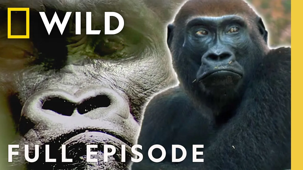
Exploring a Potential East Coast Tsunami (Full Episode) | X-Ray Earth | Nat Geo Animals
Chapters11
Introduces the idea of a mega tsunami hitting the East Coast and why it matters.
A landmark NatGeo Animals episode explores how a mega landslide from La Palma could spawn a Atlantic-crossing tsunami that threatens the US East Coast—and why preparedness matters despite the low odds.
Summary
Nat Geo Animals presents a riveting, science-forward look at a nightmare scenario: a tsunami born from the Canary Island of La Palma could ripple across the Atlantic and strike the US East Coast. Mike Angove and a team of geologists explain why the East Coast isn’t immune to tsunamis, despite lying far from major plate boundaries. The episode ties La Palma’s horseshoe-shaped volcanic structure and its history of mega landslides to a possible future collapse of the Cumbre Vieja ridge, which could send enormous rock masses into the sea. Cultural witnesses like Brittany Brand and Chris Jackson connect past events at Mount St. Helens with present-day warnings from coral-like rock formations and fault lines on La Palma. Indonesian events in 2018 and the Anak Krakatau collapse are used as modern analogs to illustrate how a landslide—not an eruption alone—could drive a multi-wave Atlantic tsunami. The program then switches to predictive modeling by Stephan Grilli, showing waves that could reach 8–10 meters inland across 14 states, with peak impacts in places like Atlantic City and Long Island. Emergency response scenarios unfold, highlighting the gap between warning centers and on-the-ground evacuation logistics, and underscoring the need for preparedness even if the probability remains low. The episode closes with a cautious call to vigilance: monitor volcanic unrest, maintain robust warning systems, and plan for worst-case, not just likely, events.
Key Takeaways
- La Palma’s Cumbre Vieja could fail catastrophically enough to trigger a landslide that displaces hundreds of cubic miles of rock into the Atlantic.
- Geologists cite multiple mega-landslides in La Palma’s history, with the 1949 fracture and ongoing seismic swarms signaling potential future instability.
- The 2018 Indonesian tsunami linked to Anak Krakatau collapse demonstrates a landslide can drive a tsunami without a major earthquake.
- Three hours of warning could exist before an Atlantic-wide tsunami reaches the US East Coast, but current warning systems may miss landslide-specific signals.
- Modeling suggests worst-case tsunamis could inundate 14 states from Florida to Maine with 3–10 meter waves, causing widespread devastation.
- Emergency response plans rely on communication networks and reverse-911 systems, yet evacuations could still be impractical on a crowded coastline.
- Scientists emphasize preparedness as essential even when the probability of event is low, given the potential scale of damage.
Who Is This For?
Essential viewing for coastal residents, urban planners, and Earth-science enthusiasts who want a grounded look at long-range tsunami risks and how warning systems translate into response plans.
Notable Quotes
"There would be a lot of anxious time waiting. Part of the problem is we don't know how big the wave would be at that point."
—Angove explains the uncertainty in early warning for landslide-driven tsunamis.
"Landslide tsunamis can turn volcanoes into long-range killers."
—Stephan Grilli emphasizes the mechanism behind the risk from La Palma and similar islands.
"The worst-case scenario landslide here at La Palma could be over 100 cubic miles of rock slamming into the ocean."
—Chris Jackson quantifies a potential mega-landslide affecting the Atlantic.
"You can't outrun it. It would be a disaster film of epic proportion."
—Angove on the speed and reach of a large Atlantic tsunami.
"These types of landslides have happened in the past, and scientists predict that these types of landslides result in tsunamis."
—Brittany Brand on historical precedent and hazard awareness.
Questions This Video Answers
- Could a La Palma landslide really trigger a tsunami that hits the US East Coast?
- How do scientists model worst-case tsunamis caused by landslides rather than earthquakes?
- What would an Atlantic Ocean-wide tsunami look like for cities from Florida to Maine?
- How effective are current US warning centers at detecting landslide-induced tsunamis?
- What signs should residents of Atlantic coastal towns monitor for potential unrest on La Palma?
La PalmaCumbre ViejaLa Palma landslide risktsunami risk Atlantic OceanAnak Krakatau collapseMount St. Helens landslide analogiestidal wave modelingtsunami warning centerscoastal disaster preparednessAtlantic City tsunami scenario
Full Transcript
(sirens, horns) NARRATOR: It's a nightmare scenario. (sirens, screaming) A mammoth tsunami strikes the Eastern Seaboard from Maine to the Florida Keys. MAN: It would be a disaster film of epic proportions. MAN: It would be sheer devastation. Mass loss of life and destruction. NARRATOR: Thousands injured or killed. Hundreds of thousands homeless. MAN: We saw this in Katrina, very similar here. It would take years for this area to recover. NARRATOR: Some scientists believe this catastrophe could happen one day. But how? MAN: It's like a detective, trying to find small pieces of the puzzle. NARRATOR: The clues are hidden deep beneath the earth.
To reveal them, we will tap the latest scientific revelations and see our planet like never before. ♪ ♪ MIKE ANGOVE: On the East Coast, if you say tsunami, that doesn't resonate. You know, it's like, no, we don't get those here, that's out in the Pacific. But there is that threat out there. (screaming) NARRATOR: December 2004. A giant tsunami strikes 14 countries in the Indian Ocean. Death toll: over 200,000. ANGOVE: Some of the footage of the Indian Ocean tsunami is really difficult to look at because of the utter destruction. And that's what makes this particular threat, for a lot of us that work in the field, take it personally.
You know, we don't, we don't want to see that. NARRATOR: Like most tsunamis, the 2004 disaster was triggered by an undersea earthquake, unleashed at the world's tectonic plate boundaries. Yet the East Coast lies far from the edges of the plates. How could a killer tsunami threaten anyone here? The answer lies 3,000 miles away. Across the Atlantic Ocean, in the Canary Islands, lies La Palma. Famed for its magical scenery, La Palma is a tourist paradise. This tiny island is barely a fourth the size of the smallest US state. Yet some experts believe it could one day unleash a tsunami that would devastate the Eastern Seaboard.
The first clue is found as we use seismic data to gaze deep beneath the island. The x-ray reveals La Palma is just the tip of a vast underwater mountain. From sea floor to summit, it's more than 20,000 feet high; two thirds the height of Mount Everest. Only one force of nature creates a conical mountain on the ocean floor. (rumbling) VALENTIN TROLL: I have a really vague recollection of seeing a volcanic eruption on television as a really small kid, and it was the 1971 eruption. NARRATOR: That year, La Palma's volcano Teneguia exploded into life. TROLL: My parents just got their first television, and I remember being quite fascinated by this.
NARRATOR: Fired up by this early glimpse of La Palma's power, geologist Valentin Troll became a world authority on this volcanic island. TROLL: This is what geologists call an ocean island. It's a bit like the Hawaiian Islands; they happen to be in the center of the Pacific plate, but here we're talking about the Atlantic Ocean. The hot rock that's rising up will actually pour out of the ocean floor and slowly, gradually build up a volcano. NARRATOR: With La Palma 3,000 miles from the USA, how could its volcanoes possibly pose a threat? TROLL: Everybody was intrigued by the shape of the island.
It's given rise to all sorts of models, theories, speculations about how the island formed, how it evolved, because it hides a secret. NARRATOR: A secret so lethal, it could devastate the US East Coast. And a secret so big, it can't be seen from the ground. TROLL: As a geologist, you mainly work on the ground, so having the chance to look at things from a bird's-eye perspective is usually extremely helpful. NARRATOR: In the center of the island, Professor Troll can finally see the mystery of La Palma. TROLL: There is a huge hole in the middle of the island.
And this is a big chunk of material that's missing. NARRATOR: Mammoth cliffs ring a vast semi-circular crater. Geologists first thought it could have been blasted out by a volcanic eruption. TROLL: Volcanic craters tend to be circular. But we don't have a complete circular feature here. It's only a horseshoe shape. NARRATOR: The horseshoe crater dominates the island. If a volcanic eruption didn't carve it out, what did? And why do some scientists believe it's a clue to why La Palma threatens the USA? The answer may lie more than 5,000 miles away, in America's backyard. BRITTANY BRAND: Even though I've been working at Mount St.
Helens for 10 years, every time I visit, it gives you the same sense of excitement. You're truly entering a place that has changed science. And I'm one of the lucky ones that get to study it. NARRATOR: Professor Brittany Brand investigates the site of America's most infamous eruption. Yet it's not St. Helens that's drawn her here. Instead, an enigma far from the volcano. BRAND: All of the rock that we're seeing is volcanic. In fact, it's lava rock. We can tell that because of the nature, it's very hard. This lava rock typically is found inside or along the flanks of the volcanoes.
The problem is we're 10 miles from the volcano here. This isn't supposed to be here. NARRATOR: But how does this evidence help explain the threat to the US East Coast? BRAND: If you look at the fine grained stuff in between this rock, it's extremely shattered and broken. This only happens when you have a mass movement, where you have these large blocks as they move, grind and bang together. There's only one explanation. What brought these rocks here wasn't the eruption, it was a landslide. NARRATOR: In May 1980, magma tremors shook St. Helens apart. In seconds, the entire northern flank collapsed.
A million Olympic swimming pools' worth of rock poured down the slopes. It was the biggest landslide ever recorded. And it popped the lid off the volcano, triggering the eruption itself. BRAND: It wasn't until the eruption of Mount St. Helens that scientists truly recognized that volcanoes fall apart. They might look like these big, tall, strong mountains, but they're not. They're made up of rubble and ash, and they're weak. It all made sense! Volcanoes fall apart. NARRATOR: St. Helens' collapse also left a telltale piece of evidence. BRAND: Normally in volcanoes we expect to see circular craters, but here we see a giant horseshoe-shaped gouge, where a massive piece of land slid away, resulting in this landslide.
NARRATOR: Could an apocalyptic landslide explain the horseshoe crater on La Palma? If so, where's all the debris? Now we change the angle on our x-ray of the undersea volcano. Covering the slopes, the x-ray reveals the rubble of not one but multiple epic landslides. They cover 700 square miles, more than New York, Chicago, and Seattle combined. Just one of these events was more than 50 times bigger than the St. Helens landslide. Over time, more than 200 cubic miles of La Palma has collapsed into the sea. What happens if La Palma suffers another mega landslide? (roaring) Could it unleash a tsunami that strikes America's East Coast?
Modern science had never witnessed a volcano collapse into the sea. But in 2018, an eruption rocks an Indonesian island and changes everything. NARRATOR: December 2018. One evening, local carpenter Bayul Sombolo was savoring this tropical paradise. NARRATOR: Bayul Sombolo had barely survived a tsunami. These deadly walls of water are usually triggered by massive undersea earthquakes. But that December night, no major earthquake took place. Professor Stephan Grilli at the University of Rhode Island believes he may have an explanation. STEPHAN GRILLI: Tsunamis are a real threat. We should not ignore them, put our head into the sand. If we know there is a potential for that to happen, we have to prepare for it.
NARRATOR: He thinks there's another force, besides earthquakes, that can unleash killer waves: landslides. GRILLI: The block here, which is part metal, part wood, has potential energy. Then upon release it's going to be transformed into the energy of movement, kinetic energy, making waves. (crash) NARRATOR: Looking closer, we can see how a landslide becomes a killer wave. The mass displaces a huge amount of water which rushes forward. As the tsunami approaches shore, the rising sea bed forces it to tower higher. And it's not just a single wave. GRILLI: We see two, three, four, five, six, seven, eight waves propagating.
In reality they would be separated by minutes. And the impact would last for maybe an hour and a half. NARRATOR: Could a giant landslide explain the devastating 2018 tsunami in Indonesia? And if so, where did it come from? DAVID TAPPIN: The challenge here is to find out the cause of the tsunami. And it's like a detective story, it's like Sherlock Holmes. NARRATOR: Far from the coast, marine geologist Dave Tappin hunts for something big enough to have unleashed a mammoth landslide. And he has a prime suspect. 25 miles from shore, the remains of an island volcano simmer.
TAPPIN: We're looking right into the heart of the eruption. NARRATOR: Anak Krakatau erupted the same night as the tsunami. But the distance from shore made it hard to see exactly what happened. Could a landslide here have unleashed the killer wave? TAPPIN: What nobody has done yet is to look under the sea. Today, we have a marine survey, to go out and map that seabed, to find out what happened underneath the sea surface. NARRATOR: Professor Tappin's team are the first to look deep beneath the seas to investigate the deadly tsunami. TAPPIN: We have on board the vessel a seismic source.
It creates a bang, and the sound travels downwards through the water column. It goes to the sea bed and then it travels beyond, into the interior of the earth. And from this data we can build up a picture of what the cause of the tsunami actually was. NARRATOR: The team's fresh data reveals an earth-shaking sight. The sea bed is littered with blocks of rock hundreds of feet high. Their jagged edges tell us they were made as the volcano fractured and collapsed. Anak Krakatau's killer tsunami wasn't caused by the eruption but by a catastrophic landslide. Final proof is the giant horseshoe crater, carved out as the landslide destroyed the slopes, and exposed the boiling heart of the volcano.
For the Atlantic island of La Palma, Anak Krakatau finally gives modern scientists the evidence. Landslide tsunamis can turn volcanoes into long-range killers. Now one scientist is on the hunt to find out how dangerous this island could be. MAN: The worst-case scenario would be that the tsunami could actually impact the Eastern Seaboard of the US. CHRIS JACKSON: On days like today, I think I have the best job in the world. It's like being a detective, But look at it! It's breathtaking scenery as well. NARRATOR: Geologist Chris Jackson investigates a potential catastrophe. JACKSON: Out to my left here, there's this massive expanse of dark, black, hard, jagged rock.
The scale of this thing is quite remarkable. NARRATOR: Professor Jackson hunts for clues in the rocks; signs that La Palma could be primed for a landslide big enough to unleash a tsunami. JACKSON: We can think of some volcanoes as being on the edge of collapse because they are really, really steep-sided. If the slopes become too steep, the volcano can collapse. NARRATOR: Steep slopes aren't the only danger. Professor Jackson spots omens in the rock itself. JACKSON: So one reason volcanoes collapse is because they're layered. They are composed not just of lava but also rocks deposited between lava.
And we see that here. These rocks are just a jumbled mass forming these slopes. So we add the slopes, we add the loose debris, and it's no surprise that a volcano like La Palma could collapse. NARRATOR: If nature pulls the trigger. The mammoth landslide at St. Helens was set off by magma movements from deep inside; seismic tremors that literally shook the volcano apart. La Palma's volcanoes haven't bubbled over for more than 40 years. Are they no longer a threat? Or just biding their time? JACKSON: So there's lots of evidence across this whole island about how this volcano has changed through time, about how dynamic La Palma is.
But to understand how it's behaving now and it may behave in the future, we need to look underneath it. NARRATOR: Evidence from lava rock allows us to peer deep beneath Scientists believe just over four miles down lurk two huge reservoirs of semi-molten rock. They're more than 2,000 degrees Fahrenheit and believed to measure more than 30 miles wide. But why are they here? Geologists are convinced a colossal column of heat, called a mantle plume, rises from the superheated interior of the earth. The plume is thought to be at least 20 million years old. And it's not cooling anytime soon.
TROLL: La Palma is the volcanically most active island in the entire Canary archipelago. It's the period of island growth where eruptions are quite frequent. And I would be very, very surprised if there is no more eruptions here on the island. JACKSON: If we look at this volcano, and how it's evolved over millions of years, it's likely that in the future it will erupt again. And it's likely that there will be another landslide. NARRATOR: If that landslide happens, could the tsunami really have the power to cross the Atlantic Ocean? Tsunami expert Professor Stephan Grilli models a worst-case scenario.
GRILLI: This model is a three-dimensional video simulating the collapse. The worst-case scenario would be 450 kilometers of material from the volcano would slide into the ocean. NARRATOR: That's a landslide the size of 180,000 Great Pyramids. GRILLI: That would cause massive waves. Those waves near the volcano could reach 1,000 meters. So here is the next phase, which is a wave propagation across the Atlantic Ocean. We are reaching about three hours here. Moving very, very fast, the speed of a jetliner, about 500 miles an hour. And now it's about to reach Now, another zoom on Atlantic City, shows you the impact itself...
causing an inundation that could reach 8 to 10 meters. So, a lot of flooding, and the flooding penetrates inland quite a bit of distance. And this is not just You would have multiple waves. And that tsunami impact lasts for tens of minutes, maybe hours. Depending where you are on the East Coast, the impact will occur between 7 and 12 hours after the collapse. NARRATOR: The chaos would devastate towns along 1,000 miles of the Eastern Seaboard. GRILLI: So here on the left is the envelope of maximum inundation along the coast. So you can see 14 states from Florida all the way to Maine being impacted by that tsunami.
On Long Island, it's reaching about 8 meters. Cape Hatteras it's reaching 7 and a half meters. In Florida, 5, 6 meters. So, along the East Coast based on our simulations, it would probably vary between 3 meters and about 10 meters for this worst-case scenario. Keeping in mind, of course, this is a worst-case scenario, very low probability. But still, we need to be prepared. NARRATOR: March 11, 2011. With little warning, a giant tsunami smashes into the east coast of Japan. Death toll: more than 15,000. In a worst-case La Palma scenario, some experts think a catastrophic tsunami could engulf Would the USA be ready?
NARRATOR: October 2012. Superstorm Sandy pounds America's East Coast. One of many towns ravaged is Atlantic City, New Jersey. REGINALD DESROCHES: It's very exposed. We have issues obviously with storm surge when we have hurricanes or storms as we did with Superstorm Sandy. Reginald DesRoches is an expert in disaster impact. DESROCHES: You see they're building the seawall, looks like they have about half a mile completed. NARRATOR: The new wall will lessen the blow of hurricane flooding. But the East Coast faces another threat. DESROCHES: This wall really won't do much for a 30-foot or even a 20-foot wave, I mean, the wave will just easily overtop this, overtop the boardwalk, and go well inland into, into the city.
believe the East Coast could one day be hit by a tsunami towering up to 30 feet. If the wall is breached, Professor DesRoches has seen the damage water can do. DESROCHES: I was involved in Katrina. We saw this major failure of one of the levees, and water rushed into that area, and it was completely gone. I mean, there was not a home standing afterwards. NARRATOR: A tsunami could wreak similar chaos on the East Coast. DESROCHES: These wood buildings would really have a hard time. The force from the waves are going to be very high, so these things would just pop off their foundations and fall apart.
There'll be lots of debris, you'll have glass everywhere, you'll have trees, you see this is a fairly wooded area. And many cars obviously would be floating and damaged. No power, no water. You may have fire if you have gas lines breaking. So it really would be total devastation. NARRATOR: Like other towns Atlantic City is built on an island. If the bridges go, you're trapped. DESROCHES: The people that are on the island after an event like this can't get off. And emergency troops cannot get in. NARRATOR: But the United States has scientists watching the Atlantic to alert the public if a tsunami is on its way.
ANGOVE: We have two tsunami warning centers with two people on shift 24 hours a day, 7 days a week, who are looking across the seismic networks around the world. Our capability really is based on detecting large earthquakes. But that's the blind spot. A landslide on La Palma could be triggered by a relatively small earthquake. So the first warning could be missed. ANGOVE: We don't have a network for detecting those sorts of things. So I really think that the next thing that you would see would be the news reports. Very quickly after that, we would have a warning up.
NARRATOR: Mike Angove's first picture of the size and speed of the wave would come as the tsunami passes over deep water sensors in the Atlantic. They would reveal there's around three hours till impact. The Eastern Seaboard is the most densely populated region of America. In Atlantic City alone, the summer population can swell to 400,000 people per day. Their safety lies in the hands of Fire Chief and Director of Emergency Management Scott Evans. SCOTT EVANS: As we do get notification of a tsunami, we would start our evacuation plan. All forms of communication would be utilized. We have a reverse 911 system.
We have a pretty robust social media system. We also have a alerting system on the boardwalk where a siren would blow. (siren) A nighttime event would absolutely be worse. Dramatically worse. A lot of people would be sleeping. They wouldn't get the notifications. We'd have to deal with widespread panic. It would be organized chaos is what we could say at best. NARRATOR: A worst-case tsunami would swamp first responders. EVANS: It's going to affect the entire coast, so resources are gonna get spread thin. Rescue efforts would be extraordinarily challenging. Just like other cities along a thousand miles of coastline.
But how likely is this nightmare scenario? TROLL: Ocean islands, they grow and they get destroyed. They have landslides that will take down the island to a large degree in a very short time. Valentin Troll heads for the remote highlands investigating the risk of a landslide and tsunami that could threaten the USA. X-raying the earth shows the island has collapsed previously in multiple mega-landslides. They sent vast sections of La Palma crashing into the sea. But these catastrophic events wiped out the center of the island. And there's another neighborhood that is worrying scientists today. Cumbre Vieja: the Old Ridge.
A massive mountain that dominates southern La Palma. 12 miles long and more than a mile above sea level, billions of tons or rock are piled on its mammoth slopes. This is La Palma's landslide danger zone. TROLL: Geologists are very concerned about the Cumbre Vieja region because it's very steep. Any edifice that is over about 30 degrees in slope angle is inherently unstable. Portions of the Cumbre Vieja are well above 30 degrees in their steepness. NARRATOR: Trekking higher, Professor Troll searches for clues the slope could be vulnerable to a future collapse. TROLL: This is Hoyo Negro crater, the site of the 1949 eruption.
And this was the most explosive vent of that eruption. NARRATOR: In 1949, a volcanic eruption punched a 500-foot-deep crater in the side of Cumbre Vieja. Farther along the ridge lies the site of another eruption. Just how restless is this mountain? Lava rock evidence allows scientists to build up a picture of what they believe lies beneath. In the last five centuries, not one, not two, but at least six eruptions have rocked these slopes. The whole ridge is a single massive volcano. Another burst of magma and the entire structure Today, Cumbre Vieja looks quiet. But in 2017 and 2018, scientists detected two flurries of activity right under the volcano: hundreds of small earthquakes called seismic swarms.
TROLL: This hints at magma movement underneath the island. So there is magma there, and sooner or later, some of this magma might come up and form another eruption. NARRATOR: At Mount St. Helens, rising magma cracked open the volcano and shed a huge chunk in a giant landslide. At Cumbre Vieja, restless magma could trigger a similar catastrophe. So Professor Troll hunts for clues on the surface of the steep volcano... and finds an ominous sign. TROLL: This is the fracture that opened up in 1949 during the eruption. This open fracture here is separating the rocks on my right which are in this case about one and a half to two meters higher relative to the rocks on my left.
Meaning that there was an opening of a fracture and a downwards move on this side. NARRATOR: The fracture runs two miles along Cumbre Vieja. Is this the first glimpse of a possible American catastrophe? Scientists are debating. TROLL: Some people argue this is just a surface expression of the magma that supplied the 1949 eruption. Others, however, argue that this translates into a major fault zone at depth; a fault line that runs deep into the island. If this was a fault line, then this could in theory be a slip line along which the western part of the island could be moving.
NARRATOR: If rising magma shakes Cumbre Vieja, and if the volcano cracks along the fracture line, a landslide could plunge the entire slope into the sea. JACKSON: The worst-case scenario landslide here at La Palma could be over 100 cubic miles of rock slamming into the ocean. NARRATOR: The slope points directly at America's East Coast. If the worst-case scenario came true, what can the US Atlantic coast expect? NARRATOR: Scientists think the odds are extremely low that the Atlantic island of La Palma could collapse and trigger a giant tsunami The last such collapse happened hundreds of thousands of years ago.
But the scientists are still on alert. TROLL: People are monitoring the displacement of the western flank for the last decades, and there has been no major movement whatsoever. However, the consequences would be so severe that we are well advised to really watch out and be vigilant about the evolution of the Cumbre Vieja. BRAND: These massive landslides, it's very unlikely to happen, and especially in our lifetime. But it could happen. These types of landslides have happened in the past, and scientists predict that these types of landslides result in tsunamis. So even though it's unlikely, we still need to be ready.
NARRATOR: Ready for the worst-case scenario. A summer Saturday in La Palma. For weeks, seismic monitoring stations would have detected ominous signs deep beneath the Cumbre Vieja volcano. BRAND: It's likely that we're going to see signs of unrest. Earthquake swarms or swelling of the ground, as magma is intruding toward the surface. You could see an increase in gas and even the ground heating up. NARRATOR: 3,000 miles away on the US East Coast, it's midnight. In Atlantic City, New Jersey, vacationers enjoy the bars and casinos. The locals are already in bed. In La Palma, mammoth seismic tremors crack the volcano open.
An apocalyptic landslide drives up a tsunami The wave races into the Atlantic, straight toward the United States. From Maine to the Florida Keys, emergency services would pick up the first warnings. EVANS: We would immediately try to get data to how much time we would be anticipating, what the possible size of the tsunami is. ANGOVE: There would be a lot of anxious time waiting. Part of the problem is we don't know how big the wave would be at that point. NARRATOR: Three hours before reaching the US, the killer wave passes that might give the first picture of its speed and power.
ANGOVE: It would be a little bit like doing it for the first time live if something of that scale were to happen. EVANS: We would do the best job that we could and just try to remove as many people as we possibly could out of harm's way. We would activate the reverse lane system where all lanes would be exiting the city. NARRATOR: Seconds ticking down, desperate locals race to escape the doomed shoreline. EVANS: But there wouldn't be enough time really to get, to get everybody out. Moments before impact, elevates the tsunami to heights of up to 30 feet.
Zero hour in Atlantic City. ANGOVE: You can't outrun it. It would be a disaster film of epic proportion. EVANS: It's going to disassemble the boardwalk, it's going to disassemble all wood structures. The walls would cave in, anything that had glass would break. It's gonna keep on coming. So you get the first wave that comes through, it goes all the way inland, then it's going to be sucked back into the ocean, a few minutes later you get another wave coming in that's similar or could be larger, then it comes back, sucks back in, and with it is all the debris, all the homes that have been damaged.
EVANS: Our local resources would be overwhelmed immediately. With the bridges swamped, anyone who didn't evacuate would be trapped. DESROCHES: The bridges are gonna be down, it's gonna be very hard for them to leave, impossible for them to leave, and very hard for emergency troops to come in and help them. would repeat up and down On the Florida coast, the wave could tower over 19 feet. Cape Hatteras, North Carolina, 24 feet. In Long Island, New York, it could reach more than 25 feet high. EVANS: It would be There'd be widespread, mass loss of life and destruction.
NARRATOR: Roads blocked. Homes gone. Communities isolated. DESROCHES: We saw this in Katrina, it took years for that community to come back. Very similar here. NARRATOR: Days after impact, much of the East Coast would be a ghost town. EVANS: We would probably look at a citywide evacuation here for months if not years. It would be a long time before Atlantic City would recover from this type of event. ANGOVE: There's nothing quite like a post-tsunami zone. I think it would be very difficult to predict just what the road back would be. NARRATOR: There are no signs a tsunami is due anytime soon.
But to experts, low risk is not the same as no risk. EVANS: It could happen. So being prepared for it, it just makes sense. ANGOVE: In our business, you best not think that you know where the next one's coming from, because that's when you'll be surprised.
More from Nat Geo Animals


Get daily recaps from
Nat Geo Animals
AI-powered summaries delivered to your inbox. Save hours every week while staying fully informed.