Investigating Beneath Earth's Surface | X-Ray Earth MEGA Episode | Nat Geo Animals
Chapters10
Sets up the idea of a catastrophic event starting from beneath the Earth and how it could affect civilizations.
Nat Geo's mega-episode dives into Yellowstone, Cascadia, La Palma and beyond to reveal how super-eruptions, megathrust quakes, and landslide-tsunamis could reshape Earth—and our preparedness matters.
Summary
Nat Geo Animals’ MEGA episode uses a global trek through Yellowstone, Iceland, Sumatra, Lake Toba, Cascadia, La Palma and more to explain the planet’s hidden power. Brittany Brand guides us to Yellowstone’s x-ray view of a vast magma chamber, while Rikke Pederson contrasts Yellowstone with Iceland’s visible heat sources. The program then travels to Indonesia to connect ignimbrite deposits with super-eruptions and to Lake Toba’s caldera as a benchmark for giga-eruptions. The central thread follows the Ring of Fire, mantle plumes, and unusual magmatic plumbing that fuels supervolcanoes. Adonara Mucek, Mike Rampino, Christy Till and Jamie Farrell illuminate how deeply we underestimate triggers and timelines—sometimes measured in decades, not millennia. The show pivots to Cascadia’s hidden megathrust threat under the Pacific Northwest, using GPS, seismic networks and sediment cores to sketch a worst-case but scientifically grounded scenario. It closes with La Palma’s landslide-tsunami risk and a stark reminder that warnings systems, evacuation towers, and public drills can save lives—even if worst-case events remain rare. Across a tapestry of expert voices, the film argues that understanding these planetary time bombs is crucial for resilience, policy, and readiness.
Key Takeaways
- Yellowstone hosts a colossal magma chamber more than 55 miles long and 25 miles wide, visible through seismic imaging and ice-thaw–driven heat flows.
- A Yellowstone super-eruption occurred about 630,000 years ago, with evidence of three distinct eruptions spanning 2.1, 1.5, and 0.63 million years ago.
- Mantle plumes, like the Yellowstone and Cascadia plumes, can lift and heat rock far from plate boundaries, explaining why eruptions occur far from traditional fault lines.
- Lake Toba’s caldera illustrates how a mega-eruption can leave behind a sleeping giant of magma that powers future explosions far larger than common volcanic eruptions.
Who Is This For?
Essential viewing for geoscience enthusiasts, policy makers, and outdoor-adventure readers who want a vivid, data-driven sense of how deep Earth processes could impact modern society—and what we can do to prepare.
Notable Quotes
"The first clue to the park's mysterious heat source lies over 3,000 miles away... in another place famed for its geysers and hot springs."
—Connects Yellowstone heat to global geothermal dynamics and Iceland.
"Mantle plumes... can occur anywhere in the middle of plates."
—Explains Yellowstone’s unexpected location away from plate boundaries.
"A caldera-forming eruption... would impact the entire planet."
—Drives home the global scale of Yellowstone’s potential impact.
"Three dates show three different eruptions at Yellowstone, including the 630,000-year event."
—Shows Yellowstone as a serial supervolcano.
"Landslide tsunamis can turn volcanoes into long-range killers."
—Illustrates the La Palma and Anak Krakatau tsunami threat.
Questions This Video Answers
- How likely is a Yellowstone super-eruption and what would it look like in today’s world?
- What evidence proves Cascadia could produce a megathrust earthquake and how do scientists monitor it?
- Could La Palma’s future landslides generate a tsunami on the US East Coast and how real is that risk?
- What is ignimbrite and why does it matter for understanding supervolcanoes like Toba and Yellowstone?
- How do mantle plumes differ from plate-boundary volcanism and why does that matter for hazard planning?
Yellowstone magma chamberX-ray geologyIceland geothermal activityIgnimbrite and super-eruptionLake Toba calderaMantle plumeRing of FireCascadia megathrust earthquakeSubduction zones vs mantle plumesLa Palma landslide and tsunamis
Full Transcript
(explosions) NARRATOR: It's a nightmare scenario. WOMAN: This would be more than millions of Hiroshima bombs going off all at once. NARRATOR: The world is hit by the biggest natural disaster on the planet. A super-eruption. MAN: It would be just as bad or maybe even worse than an asteroid impact. Power networks destroyed. Entire cities lost beneath ash. WOMAN: It would be heavy enough and thick enough that it would crush people and animals alive. NARRATOR: The sun dims across the globe. MAN: It would impact the entire planet, you know, economies, weather, everything. NARRATOR: The earth is plunged into a winter that lasts years.
Harvests fail. MAN: Right now we have about three months of grain stored, and after that there'd be no food. WOMAN: We would be looking at widespread famine. NARRATOR: Could this nightmare really happen? To investigate this potential cataclysm, we will use the latest scientific data to uncover the danger beneath us, as we see our planet like never before. ♪ ♪ If the apocalypse came, this is where it would start. BRITTANY BRAND: It's a gorgeous day. I'm really excited to be here. I love coming to Yellowstone. Yellowstone is one of the most incredible places in the world.
Spanning three states, Yellowstone lies in the heart of America's Rocky Mountains. BRAND: One of the reasons Yellowstone is such a spectacular place to visit is because it's an exotic landscape full of boiling mud pots... steaming hot pools... and geysers. NARRATOR: Including the world-famous Steamboat, the tallest active geyser on the planet, blasting boiling water over 300 feet high. But there is another Yellowstone, one that only scientists get to see. Our x-ray view reveals a network of water channels flowing under Yellowstone, filled with snowmelt from the mountains. But this snowmelt is boiling hot. BRAND: There's so much heat coming out the ground here.
The question is why? Why do we have so much heat? NARRATOR: The first clue to the park's mysterious heat source lies over 3,000 miles away... in another placed famed for its geysers and hot springs. RIKKE PEDERSON: I've been living in Iceland for the past 20 years studying the activity here. NARRATOR: Rikke Pederson is one of Iceland's leading geologists. Just like Yellowstone, this island churns with steaming vents, mud pots, (hissing) PEDERSON: Geyser is actually the original Icelandic word for a gusher. So, it gushes hot water onto the surface. But unlike Yellowstone, in Iceland the source of the intense heat is plain for all to see.
PEDERSON: We see the steam rising, we see the bubbling mud created by the fact that we have molten magma just a few kilometers beneath our feet. Iceland was built by volcanoes. Smaller than most U.S. states, Iceland has over a hundred volcanic sites. PEDERSON: The black landscape here is really the evidence of the very volcanic, dynamic environment in Iceland. NARRATOR: Every four or five years a volcano wakes up. (rumbling) PEDERSON: The volcanic source of the geothermal system here is evident. All of Iceland is created by volcanism. There's nothing here which is not originated from a volcano.
(whoosh) NARRATOR: Geysers in a land of volcanic mountains. And geysers in a land without them. You don't see black lava fields in Yellowstone. Yet this one park has more than ten times as many geysers as all of Iceland. Where is all the heat coming from? JAMIE FARRELL: One of the really great things about working in Yellowstone is it's so dynamic. Every time you come here you see something new. You see something different. There's always a new question, there's always a new problem. It keeps it really interesting. NARRATOR: Jamie Farrell has spent more than a decade studying what lies beneath Yellowstone.
To find out more about this huge and unpredictable system, he deploys a network of ground sensors. FARRELL: Couple pieces of equipment here. This is what I use to talk to my seismometer. And then here I have the actual seismometer. And what it does, it just measures these really slight vibrations in the ground. We record these seismic signals for the purpose of finding out where they're coming from, what does the plumbing system look like under the ground, why is it so active right now. NARRATOR: Seismic data builds a 3D image of the ground under Professor Farrell's feet.
Using this data, we can x-ray the earth to show the source of Yellowstone's extraordinary heat. Beneath the park's geothermal system, scientists discovered a spectacular sight. A vast chamber of semi-molten rock extends beneath around a quarter of the park. 55 miles long and 25 miles wide, it's one of the largest magma chambers yet discovered. Scientists believe it's more than twice the volume of the Grand Canyon. In Iceland, magma chambers a fraction of this size power violent volcanoes. Yet on the surface of Yellowstone, there's almost no sign of the monster magma chamber beneath. Why? The answer can be found along one of the most volcanic regions on the planet: the Ring of Fire, a deadly chain of volcanoes circling the Pacific Ocean.
ADONARA MUCEK: I've been coming to Indonesia for about 6 years to study the amazing geology that we find here. Geologist Dr. Adonara Mucek is an expert on Indonesia. MUCEK: We have over 120 active volcanoes. NARRATOR: One of Indonesia's most active volcanoes is Mount Sinabung on Sumatra. It's hit this island with devastating eruptions for the past nine years. (motorbike buzzing) MUCEK: Selamat pagi. MAN: Selamat pagi. Dr. Mucek is right at home at the Sinabung Volcano Observatory. MUCEK: Wow, so this is the actual ground movement readout from the eruption on the 9th of June this year. It is incredibly active.
Oh, wow, it's very clear. MAN: Yeah, clear. You see. MUCEK: Standing here today, you see such an impressive looming volcano, and you realize the danger behind it. And yet the sun is shining, the birds are chirping, it doesn't feel that dangerous. It's kind of like playing with fire. The most recent eruption, there was an ash column plume that was about seven kilometers high and pyroclastic flows that actually encompassed this whole region here that we're looking at of Sinabung. NARRATOR: Pyroclastic flows. Avalanches of boiling rock, ash and gas. Far more dangerous than a lava flow, they can move in excess of 400 miles per hour.
And they stamp a volcano's mighty footprint for miles around. In territory near the volcano, Dr. Mucek finds pyroclastic deposits. But there's a mystery. There's way too much material, even for Mount Sinabung. MUCEK: That means there's a volcano somewhere around here that is hundreds of times bigger than Sinabung. NARRATOR: Where is the mammoth hidden volcano? And can it explain why the peaceful Yellowstone could one day turn into a mass killer? NARRATOR: Clues to the mystery behind Yellowstone's benign appearance lie on the Indonesian island of Sumatra. MUCEK: So we've left the observatory and we've headed south into the Sumatran forest.
And what I'm looking for is eruptive material. NARRATOR: Volcano expert Dr. Adonara Mucek hunts for evidence of Indonesia's deadly eruptions. MUCEK: This particular site looks like a good place. From a patch of exposed rock she digs out a clue. MUCEK: These lines appear to be fibrous glass, which would mean that it's actually from magma that's been sort of stretched and then rapidly cooled to form this sort of texture that we see. The name that we give this type of eruptive material is ignimbrite, and ignimbrite is actually formed from really large pyroclastic flows. NARRATOR: Dr. Mucek is in the shadow of Sinabung, a recently active and highly dangerous volcano.
MUCEK: So you might think that this ignimbrite came from Sinabung. However there is a problem. Sinabung is not a big enough volcano to have produced all of this ignimbrite. This ignimbrite is really thick and covers an extensive area. In some places the thickness of this ignimbrite is over 300 feet. What we see here is just the tip of the iceberg. And that means there's a volcano somewhere around here NARRATOR: But where? Indonesia has no volcanic mountain even close to a hundred times the size of Sinabung. Could a giant volcano be hiding in plain sight? (motor humming) The riddle takes Dr.
Mucek further south, to a massive body of water nearly 20 miles wide and 1,500 feet deep: Lake Toba. In the center is the island of Samosir. Here mammoth cliffs tower more than 2,000 feet high. But the rock at the very top is not what you'd expect. MUCEK: The material we find at the top of these cliffs are actually lake sediment. And lake sediment would have originated from underneath the lake. NARRATOR: How did rock from the lake floor end up thousands of feet in the air? MUCEK: It would mean that something would have pushed these lake layers up, through the lake and above the lake to these great heights, and geologists have found that this force that's pushed the ground upwards to form this island is magma.
NARRATOR: Like at Yellowstone, beneath these waters lie vast quantities of magma. 74,000 years ago a colossal eruption blasted out in a ring. The volcano collapsed on itself, creating the enormous crater, called a caldera. Then, over thousands of years, restless magma pushed up the telltale island in the center. MUCEK: If you're looking for the volcano, this is it. We are in it right now. Lake Toba is the volcano. A mammoth caldera like this is the signature of the most powerful natural disaster on Earth, a super-eruption. MUCEK: The strength of a super-eruption would be more than millions Everything within a radius of around 200 miles was completely incinerated.
NARRATOR: A super-eruption, a supervolcano. Today Toba hides its cataclysmic history, because the eruption was so big, the volcano destroyed itself. Like Toba, Yellowstone sits above vast stores of magma. Could Yellowstone be a supervolcano? If it is, where's the caldera? BRAND: Lake Toba is a classic example of a caldera. So when we're thinking about super-eruptions and evidence for super-eruptions, we would expect to see a similar caldera here at Yellowstone. But when we look around, we don't see an obvious caldera. NARRATOR: On the western edge of the park lies a clue: a sheer cliff. BRAND: These cliffs tell us two things.
One, certainly lava has erupted here, so they're volcanic. But even more interesting is why it's a cliff. Lava flows aren't going to form a cliff face. Something had to have happened to expose this lava. Something really big. The ground where we stand at one point would have been up at the top of those cliffs, and it would have catastrophically dropped down to expose what we see today. And the only way that can happen is in a super-eruption. (thunder) So, these cliffs are really good evidence that we may be on the edge of a caldera, but the next question then is where's the rest of the caldera?
When we look around Yellowstone, we don't see an obvious depression, so where is it? NARRATOR: To solve this puzzle, we need to peer hundreds of feet underground. Using data from rock samples gathered across Yellowstone, scientists can build up an x-ray view of what lies beneath: a vast crater more than six times the size of Chicago. A hidden caldera. BRAND: So, Yellowstone does have a caldera, and from this vantage point we can see why it's so hard to see it. The first reason is because it's absolutely enormous. It's 32 miles across. The second reason is this ancient caldera has been almost completely filled in.
This proves that Yellowstone is a supervolcano. NARRATOR: The power to unleash a global apocalypse lies right here. Could the sleeping giant ever wake up? NARRATOR: The remote wilderness of Yellowstone is also a supervolcano, with the power to threaten U.S. cities from San Francisco to Chicago. What could push Yellowstone over the edge? CHRISTY TILL: So I first came to Yellowstone like many people on a quintessential American road trip when I was a kid, long before I knew I would be a geologist. To investigate the mechanics of Yellowstone's eruptions, volcano expert Christy Till digs into its violent past.
TILL: Oh, this looks promising. Let's get a bit closer, it looks even more promising. Yes. This is exactly what we're looking for. This is a beautiful eruptive deposit. I see horizontal layers. A very consolidated layer up here. This would be what we would call a welded ignimbrite. NARRATOR: Ignimbrite. A fifty-cent word with a megaton punch. And it's the same material piled high round Indonesian supervolcano Toba. TILL: There's over a thousand cubic kilometers all over Yellowstone. We see cliffs of over 400 meters of it. Avalanches of boiling ash once raced across the land. TILL: You would not want to be anywhere near Yellowstone at the time of that eruption.
NARRATOR: Dating the Yellowstone ignimbrite reveals a super-eruption from 630,000 years ago. But that's not the only remarkable fact hidden in the rocks of Yellowstone. TILL: When we look at those dates, we see three different dates, we see three different timestamps of three different eruptions! So, there were three gigantic eruptions at Yellowstone, including this one. That just blows my mind. NARRATOR: Yellowstone didn't just have one huge eruption. This is a serial supervolcano. TILL: It had the first of its super-eruptions about 2.1 million years ago. Then another eruption about 1.5 million years ago. And finally, its most recent super-eruption about 0.6, or 630,000 years ago.
So, each of those created a giant depression in the ground that subsequently filled up with lavas that were erupted afterwards, and then the cycle started all over again. NARRATOR: Is Yellowstone headed for cataclysm number four? To find out, we need to see what triggers volcanic eruptions. (gulls squawking) MIKE RAMPINO: Volcanoes are found, in relation to the tectonic plates, they're at the plate boundaries between the plates, whether the plates are moving apart or coming together. Professor Mike Rampino visits one of the few places on Earth where tectonic plates can be seen pulling apart on land. RAMPINO: We're standing here on a plate boundary, this rift that runs through Iceland where the plates are diverging.
They're being pulled apart. We're standing here on the European side, and that plate over there is connected to the North American plate. If you sit here long enough you could actually see the plates moving. But they only move at about one centimeter per year, so you'd have to stand there for quite a while. And of course, there's volcanism because as the plates spread apart, magma comes up from below. NARRATOR: 95% of the planet's active volcanoes form at these plate boundaries. But Yellowstone doesn't play by the rules. BRAND: Yellowstone's really an anomaly because we're not at a plate boundary.
We're in the middle of the North American plate. NARRATOR: The nearest boundary is over 800 miles away. So if colliding plates couldn't trigger a super-eruption here, what could? With seismic data gathered across the United States, we can produce an x-ray view of what's happening The continental plate of North America floats on the earth's mantle, a layer of semi-molten rock. In 2018, scientists discovered a 220-mile-wide anomaly in the mantle. A column of semi-molten rock believed to be hotter than its surroundings, rising from the interior of the earth like a giant lava lamp. It's called a mantle plume.
BRAND: Mantle plumes, because they're derived from so deep within the earth, they can come up anywhere. They don't have to be centered at tectonic boundaries like most of our volcanoes. They can occur anywhere in the middle of plates. And so here at Yellowstone that's exactly what's going on. You've got a mantle plume coming up from very deep and puncturing up through the crust. NARRATOR: A plume this vast could provide the ammunition for a doomsday eruption. But what could pull Yellowstone's trigger? Yellowstone National Park sits on dangerous ground. X-ray views of the earth reveal a vast magma chamber capable of inflicting disaster on the planet.
How restless is this colossal source of power? DAVID MENCIN: We work all year round in any conditions. Today we're having a nice fall day, rain turning into snow and sleet. We come here in the winter, summer, winter's my favorite. But more challenging, there's a lot of snow, got to use skis and snowmobiles to get around. NARRATOR: In a remote corner scientist David Mencin tracks the magma's behavior. MENCIN: We're here to measure the ground movements, how the ground is reacting to the magma chamber underneath in order to determine what it's doing. And we're going to use GPS equipment, the same kind of equipment that's in your phone but a much higher grade, where we can get millimeter-level precision.
And then we have a GPS antenna. It measures the distance between the GPS satellite and the antenna, and we measure the change in position of the antenna over time, and that tells us how the ground is moving over time and therefore tells us how the magma chamber is changing over time. We've learned that Yellowstone is moving up and down, so parts of the park are moving up and parts of the park are moving down. A whole area of 10 kilometers will go up, you know, 10 centimeters, or in this area next to it, it will go down.
So what that indicates to us is that the volcano is restless. It moves. What that means is that there's magma or fluids moving around beneath the surface. Despite its appearances, Yellowstone is an active volcano, and in fact it's the largest active volcano in the world. NARRATOR: But what would tip the Yellowstone magma chamber into another eruption? TILL: The way these magma chambers work is very different than that boiling hot cauldron of magma that you might imagine is below a volcano. In fact, many of these magma chambers are mostly crystallized. Think about a slushy. When you first get a slushy, it's mostly ice, and you can't drink it through a straw.
You need it to warm up a little bit over time so that there's more liquid that you can drink through the straw along with that ice. NARRATOR: What would it take to go from geological slushy to super-eruption? TILL: Something would have to happen. We need to have a new flux of magma into the magma chamber to warm it up, to get it to be more liquid. More than 50% liquid to get it to erupt. For now, the data suggests no more than 15% of is liquid. Far below the 50% tipping point. How fast could things change?
Geologist Hannah Shamloo hopes to answer this big question by finding something very small. HANNAH SHAMLOO: Here we're looking at a package of ash from Yellowstone's most recent super-eruption. One of the most exciting parts of this ash are the crystals that are contained within it. And I can already see some very large, nice crystals. These crystals are like time capsules of information. What was happening beneath the volcano before it erupted? NARRATOR: Slicing the crystals reveals layers of growth over time. Like tree rings, these layers record what was happening in the magma chamber, right up to Yellowstone's previous super-eruption.
SHAMLOO: What we think happened is that an injection of fresh, slightly hotter magma entered the reservoir and basically caused the magma to be a little more liquid and more eruptible, ultimately leading to its eruption. And we really had no idea how long these processes took. Millions of years? Hundreds of thousands of years? But the research revealed a very different time scale. SHAMLOO: What these crystal rims are telling us is that from the point of injection to eruption takes no more than a few decades. What we're finding is that they happen on the scale of a human lifetime.
NARRATOR: The discovery doesn't make a super-eruption any more likely. But it does mean if the magma started to move, Yellowstone could turn deadly far more quickly than we knew. Yet that would need an injection of large volumes of molten material into the magma chamber. Where could it come from? In 2015, Jamie Farrell and his colleagues were making seismic scans deep beneath the Yellowstone magma chamber. FARRELL: What we're looking at here, this is a cross-section through the Yellowstone Caldera. On the top of this image we have the magma reservoir, of which we've known for quite a while now is already one of the largest magma reservoirs that we've seen on the earth.
But immediately below we see this, this kind of orangish, reddish area. This feature has never been seen before. NARRATOR: Incredibly, beneath Yellowstone's magma, the scientists had discovered a second mammoth chamber four and half times bigger. In a worst-case scenario, this far larger store could inject magma into the upper chamber, pushing it over the edge. Nothing suggests the supervolcano will go off anytime soon. But we know it detonated on an epic scale three times before. If Yellowstone did erupt again, how catastrophic would it be? NARRATOR: In 2010, Professor Mike Rampino saw the volcano Eyjafjallajökull blow its top.
RAMPINO: We were up in a helicopter filming the eruption, you could see the plumes of ash. You could feel the shockwaves from the explosions. You could see huge blocks being thrown out of the volcano. NARRATOR: Ripple effects spread across Europe. Air travel was shut down. RAMPINO: The ash is like glass, and as it's taken into the jet engine, it's melted, and then it coats the inside of the engine and blocks the jet, and then the engines turn off. NARRATOR: More than 95,000 flights were cancelled. Yet this was a geological blip compared to the ancient super-eruptions of Yellowstone.
RAMPINO: Eyjafjallajökull was a very, very small eruption. Less than one cubic kilometer, mostly ash. And Yellowstone, we're talking about more than a thousand cubic kilometers. NARRATOR: An ash cloud from Yellowstone wouldn't just ground aircraft... or just hit nearby towns, like the 1980 eruption of Mount St. Helens. It would blanket more than half the country. What would this mean for people and animals? MEAGHAN WETHERELL: The great thing about this place is it's incredibly well preserved, so you can really see all of these amazing clues to paleoecology of ancient Nebraska and some really interesting clues about volcanic eruptions of the past.
NARRATOR: Paleontologist Dr. Meaghan Wetherell visits the scene of a cataclysm, looking for answers. WETHERELL: It is immense! There's just skeletons everywhere. This is a whole bunch of dead animals, which should be theoretically sad, but as a paleontologist this is riveting stuff; you never get stuff like this. NARRATOR: 12 million years ago, when these animals died, Nebraska looked like Africa. This site was a watering hole. WETHERELL: The first thing that really catches my eye out here is this enormous rhinoceros skeleton. There's a little one that is next to it, and this is a baby. This looks like a really beautiful, touching moment.
In actuality, this is a death moment, a moment where this calf and this mother died together. There are many, many others. In fact there are so many full skeletons, this is what you would call a death assemblage. All these animals died within weeks of each other. But what killed them? WETHERELL: You can see all over this rhino bone, there's this bumpy, really frothy-looking texture. That's not normal. This is normal. This is diseased. And the answer here is probably hypertrophic osteopathy, or Marie's Disease. NARRATOR: Marie's disease usually results from severe lung damage. WETHERELL: The culprit is probably the same thing that actually buried these animals.
It's ash. They're coming out of a foot-thick bed of ash that covers a huge swath of Nebraska. this ash choked them, killed them, and buried them. It came from an ancestor of the supervolcano A super-eruption in the U.S. today could wipe out up to 20% of all Americans. Disaster would spread across the globe, judging by an event just 200 years ago. RAMPINO: 1816 is very famous in history as the year without a summer. It snowed in the eastern United States in July and August. Frost killed the crops. In Europe there was famine. NARRATOR: Food riots broke out around the world.
More than 82,000 people died, many from starvation, all thanks to a volcanic eruption the year before. RAMPINO: A volcano called Tambora in Indonesia. One of the biggest in historic times. NARRATOR: How did an eruption on the far side of the earth create a year without a summer in Europe and America? It wasn't the ash cloud, but tiny particles belched out by Tambora. (wind howling) RAMPINO: Sulfur dioxide is interesting because when it gets into the upper atmosphere it combines with water and makes little droplets of sulfuric acid, and that builds up in the atmosphere, forms a veil, and so it cuts out the sunlight.
NARRATOR: Sulfuric acid from Tambora dimmed the sun across the world for a year. And this wasn't even Yellowstone's eruptions were at least ten times more powerful than Tambora. RAMPINO: For something like Yellowstone, the cooling was on a global basis maybe five degrees or more. And 5 degrees doesn't sound like a lot, but that's the difference between now and an ice age. A global volcanic winter that lasts years. RAMPINO: Imagine a world with no growing season, maybe several years without summers, crops failing all around the world. And right now we have about three months of grain stored that would feed the world for three months, there would be no food.
NARRATOR: Humans weren't around for Yellowstone's last super-eruption. If there is another, what would happen when a civilized world met a volcanic juggernaut? NARRATOR: Simmering beneath are two of the biggest magma chambers yet discovered on Earth. The worst-case scenario: These events are utterly devastating but incredibly rare. MENCIN: The probability in any given year is one in a million. So it's improbable in our lifetime, but it's something that will happen. RAMPINO: In our lifetimes, it may be a one in a million chance, but Yellowstone is going to erupt again. FARRELL: It's important that we understand these things because we know they've happened in the past and they can very well happen in the future.
MENCIN: What we can say about it, though, is that we would have some warning. We would get on the order of a decade, or decades of warning. So what would it look like if the worst-case scenario played out for real? Around 20 miles beneath Yellowstone, the mammoth magma store begins to heat up and inject molten material into the upper chamber. TILL: We would know. There'd be certain special kinds of earthquakes and ground deformation from that magma that was moving in under the volcano. MENCIN: It could also manifest itself in increased gases coming out of the hydrothermal system.
As the upper magma chamber reaches its tipping point, the Yellowstone supervolcano gets ready to blow. MENCIN: What we understand now is that these eruptions, you know, we get all these warnings, but then when they do actually occur, they occur very quickly. (hooves pounding) A caldera-forming eruption, which humans have never seen, is on the scale of like a meteor impact. It would impact the entire planet. NARRATOR: As the super-eruption intensified, 240 cubic miles of material would be hurled upwards, reaching halfway to outer space. But what goes up must come down. FARRELL: As that column builds and builds and builds and gets heavier, it eventually gets too heavy to support itself and it starts falling back down to the earth, and that's where we get what we call pyroclastic flow.
NARRATOR: Traveling at up to 400 miles per hour, burning at nearly 2,000 degrees Fahrenheit, nothing in their path would survive. BRAND: Anything within a hundred-mile radius of Yellowstone would be completely wiped out. TILL: It would be like wiping out the peninsula of San Francisco in just a matter of minutes. NARRATOR: Those who escaped the boiling avalanches wouldn't escape the thick toxic ash. It would rain down for weeks. BRAND: Ash would blanket the United States. WETHERELL: Within 200 kilometers of the crater scientists estimate it would be NARRATOR: Highly charged dust would short-circuit powerlines, destroying the electricity grid...
plunging the country into darkness. Daily life would grind to a halt. WETHERELL: Air travel is going to be shut down in huge swaths of the world, not just in the continent. NARRATOR: While America choked, disaster would encircle the planet. Billions of tons of sulfur dioxide would send global temperatures plummeting. FARRELL: The big thing is they pump a lot of material and gases up in the upper atmosphere. You don't necessarily get dark, but it just gets really cold, and then crops fail. BRAND: We would be looking at widespread famine due to crop loss, would almost be unfathomable.
NARRATOR: Earth would be in the grip of a 5-year global winter. Within years, millions would starve. RAMPINO: It wouldn't be a mass extinction event, but it might be a civilization-ending event. The famine, the civil unrest; wars that might break out, disease. All those things would happen in the aftermath of the supervolcanic eruption. Humanity's saving grace is that super-eruptions are uncommon events. BRAND: They're incredibly rare. But even though they're very rare, it's still important to understand what the effects of such an eruption might be. It's really just something that as a geologist I hope does not happen in our lifetime.
(car alarm) NARRATOR: Seattle and Portland lie in ruins. The devastation spreads 600 miles along the Pacific coast. Rivers burn. 45,000 injured or dead. CHRIS GOLDFINGER: This is a big problem. And we're living inside the time bomb. WILLIE NUNN: Bridges, at least half will be collapsed or damaged. The police department, half of those. The hospitals, two thirds devastated. Entire towns swept away. It could take decades to rebuild. NUNN: We're going to have blackouts for months at a time. We're looking at years of recovery. (glass shattering) NARRATOR: This disaster hasn't struck yet, but it will. GOLDFINGER: We're in a race, and it's a race that we're going to lose.
NARRATOR: What will trigger the catastrophe? Now using the latest scientific data, we can peer deep inside our planet to reveal the mounting danger right under our feet. HAROLD TOBIN: It's going to be the most devastating event that's ever taken place in North America. NARRATOR: Low tide reveals the first clues to the fate of the Pacific Northwest. GOLDFINGER: Tree stumps in the beach, kind of an odd thing. Can see the whole beach is covered with these things. There's probably, looks like a couple hundred of them. NARRATOR: Beneath the sand, our x-ray shows these stumps were once a mighty forest.
GOLDFINGER: It's pretty amazing. They're western red cedars that don't rot. I'm lucky to have this job. It's great. (chuckles) NARRATOR: This is just one of dozens of sites along the coast. GOLDFINGER: To actually see this stuff and see the scale of it, and realize that this has happened all up and down the coast for a thousand kilometers, this is big stuff. NARRATOR: And a big mystery. GOLDFINGER: They really have a low tolerance for salt water, so they really shouldn't be anywhere near here. If we dig into this a little bit more, we might learn something important.
NARRATOR: Something that could save thousands of lives from a natural disaster. Neskowin Beach sits at the heart of the Pacific Northwest. An emerald blanket stretching across three states. Home to millions, many of whom live in two of the region's most important cities. Meccas of technology and innovation coupled with historic beauty and culture: Portland and Seattle. ERIN WIRTH: I love it! I think there's a great quality of life. There's a lot to do out here outdoors, and it's a beautiful city. DOUG TOOMEY: It's an area with beautiful mountains, beautiful ocean. From a geologist's point of view, it's a wonderland.
TOBIN: We have the mountains, we have the sea, we have kind of all of the hills and all of the beautiful topography of Cascadia. I wouldn't choose to live anywhere else. But each scientist knows the region's stunning beauty masks a deadly threat. Nearly 150 miles north of Neskowin, in the salty water of the Copalis River, geologist Dr. Carrie Garrison-Laney searches for clues. CARRIE GARRISON-LANEY: I do love digging in the mud. And a friend of mine I hadn't seen in 30 years said, "Oh, you did end up digging ditches after all." (laughs) To Dr. Garrison-Laney, this mud is a time machine.
Locked away in its past: more freshwater trees. GARRISON-LANEY: What we're looking at here are roots from the Sitka spruce. The trunks have long since rotted away, but the roots have persisted because all of this mud closed in on top of them. It looks pretty innocuous, but this is definitely a murder scene. This was a forest. We would have seen very tall trees. This area would have been much higher. So, what we can tell is that the land level dropped by at least this much. NARRATOR: Sites like this are found along this coast from northern California to Vancouver Island, where the land plunged by up to 36 feet.
GARRISON-LANEY: What you're looking at is the evidence of a large-scale disaster. The widespread destruction suggests the work of one force. GARRISON-LANEY: This is a very compelling package of land level drop like we see in subduction zone earthquakes. And the greater the amount of subsidence, the greater the earthquake. NARRATOR: South of the Copalis, the land around Neskowin collapsed to sea level, and the freshwater trees perished. The force that unleashed that titanic earthquake lies deep beneath the geologists' feet. Using data collected from a vast array of sensors buried across the Pacific Northwest, we can now x-ray the earth to reveal what caused the devastation.
As the North American continent pushes westward, the x-ray shows it grinds atop the Pacific floor. Geologists call the fault line where the plates meet a subduction zone. Right now these trillion-ton slabs are locked in place. When they slip: earthquake. At 620 miles, Cascadia is one of the longest unbroken faults The millions who live here could be hit by one of the deadliest types of earthquake: a megathrust. It's hard to visualize how much power that is, but it dwarfs the largest atomic explosions by, by a lot! NARRATOR: The modern cities of Portland and Seattle have never seen a megathrust.
If you go to Japan or Chile, it's hard to go a week without feeling some sort of earthquake. But in Cascadia, I've been here since the 1980s, and I have, I felt one. TOBIN: It's unlike every other subduction zone in the world. There just haven't been any significant sized earthquakes at all. NARRATOR: Back on the Copalis River, Dr. Garrison-Laney finds another eerie clue. GARRISON-LANEY: It's a really spectacular collection of dead trees, known as the Ghost Forest. In the past we would have been in a very dense spruce and cedar forest, and then the ground level lowered.
And within a few minutes, the tide water rushed in. So that would have killed these trees very soon afterwards. NARRATOR: Just like at Neskowin Beach, except here whole trees remain, making it possible to date them. GARRISON-LANEY: Tree ring patterns are very unique. And we're able to show that the last ring that was put on, was the same year in all the same trees, the year 1699. NARRATOR: Late that year or early 1700, a huge earthquake dropped the land across tens of thousands of square miles of the Pacific Northwest. Based on the vast area affected, geologists calculate the quake was as large as a magnitude 9.2, nearly 30 times more powerful than the 1906 quake that leveled much of San Francisco.
In the last 350 years, only six quakes this big have shook the earth. Despite its deceptive serenity, the Cascadia fault is a card-carrying member of this infamous list. It's a beautiful place to work, there's lots of amazing nature around, but we need to remember the message that Earth's telling us. For more than 300 years, the Cascadia fault has been virtually silent. As geologists, we're fascinated about the processes and all that stuff, but many of us live here as well. And we're living in the middle of this, like, inside the time bomb. NARRATOR: When you're sitting on a geologic time bomb, one question hounds you: Could the bomb go off?
GOLDFINGER: It is ominous that it's so quiet. What are the chances that this is the only aseismic subduction zone in world? NARRATOR: So is the Cascadia fault dead, or could it slip catastrophically again? Especially considering the neighborhood. The Pacific Northwest sits on the notorious Ring of Fire: a cauldron of seismic plates and simmering volcanoes ringing the Pacific Ocean. GOLDFINGER: If you go around from Alaska and Japan and the Philippines, you've got a dozen or more subduction zones all active at the same time. NARRATOR: It generates 90% of the world's earthquakes. TOOMEY: And those earthquakes can be very damaging as we've seen throughout the Pacific Rim area.
NARRATOR: Japan. New Zealand. California. Everywhere on the Ring of Fire, the earth's tectonic plates grate on each other. As they bend and buckle, they store up energy like a spring. When the plates slip, they release all that energy. Portland and Seattle straddle a 600-mile-long no-man's-land, where the Pacific and North American plates meet. The question is, what are the plates doing? The fate of millions is stored in an array of simple GPS stations. Professor Goldfinger has spent more than 20 years analyzing the data. GOLDFINGER: There used to be just 5 or 6 stations. Then once we got a few stations like that, then more is always better, and you start infilling with as many as possible.
NARRATOR: The GPS coordinates from these stations tell Professor Goldfinger if the plates are stationary or moving. GOLDFINGER: If you have a subduction zone like this, and you put a GPS station on the land like this, if it's not locked, you would expect no motion relative to the interior. But if it is locked, then stations should show that they're being pushed inland. The first GPS stations pretty clearly and quickly showed that all of the leading edge was moving to the east. NARRATOR: Pushed by the Pacific plate. All along the fault line, the two plates are quietly locked together.
A bizarre oddity in the Ring of Fire. What force is so powerful to jam the plates together? An array of over 1,100 sensors, on land and off the coast, generate an x-ray of the earth. More than 150 miles beneath the Pacific floor is a sea of semi-molten rock: the earth's upper mantle. The x-ray reveals two huge anomalies, each about 125 miles wide. Super-heated rock rising from deep within the earth, called plumes. As they rise, they push up the Pacific floor, forcing it into North America, and jamming the two plates together. Geophysicist Doug Toomey walks right on top of the southern mantle plume.
TOOMEY: The megathrust is a couple of kilometers below us here at this point. If you were to strip away the oceans and look at the sea floor, you would see hot spot tracks in the northeast Pacific. And those hot spot tracks are mini plumes of hot, partially molten rock that's rising upwards. NARRATOR: The rock in the plume is hotter, so it's more buoyant. TOOMEY: So you can think of it as a balloon or something that's lower density that wants to rise up and push beneath that subducting plate. Simple kitchen physics shows how the plumes lock the plates.
The ball represents a plume, and the sheet, a tectonic plate. TOOMEY: This ball, made of Styrofoam, that, clearly very buoyant, and wants to rise quickly through the water, and it'll mimic the buoyancy we have in the earth. NARRATOR: The data confirms buoyancy has helped lock the Cascadia fault for more than three centuries. As the North American plate bends like a spring, more energy builds up. The longer it builds, the greater the power unleashed when one plate finally slips. TOOMEY: It's accumulating all that deformation. But eventually all that has to be released. So, at some point in the future it's going to slip catastrophically.
Millions live in the shadow of this natural disaster. TOOMEY: The question is, you know, when's the next one? (siren) NARRATOR: Most natural hazards give warning before they strike. Hurricanes. Even volcanic eruptions. But predicting when the earth will quake is like predicting when a temperamental child will erupt. Good luck. TOBIN: Every day is earthquake season. And you'll hear people talk about earthquake weather. And people have studied this intensively, there just is no such thing. There's no particular time of year they strike. There's no particular phase of the moon when they strike. None of those things really make a difference for these very large earthquakes.
GOLDFINGER: We know energy is going into the system. The one thing that we all wish we could tell is how much energy has it stored. It's like a charging battery. You put the leads on and turned it on, and then the little red light is blinking, but we don't have the dial that says how full the charge is. (beeping) NARRATOR: Professor Goldfinger can't foretell the next quake to strike his home, But he can search for clues in the past. GOLDFINGER: The thing about earthquakes is, if it happened once, it's probably happened a thousand times. looks for a pattern to the Cascadia fault quakes, but not on land.
For years, scientists have been extracting cores of sediment from the sea floor. It's a very quiet environment. Sediment just rains down. It's a very smooth-running tape recorder. This section comes from the megathrust earthquake of 1700. The disturbed sediment was washed off the land during the great quake. GOLDFINGER: There's 300 to 400 years of material here. And this is the sea floor as it was just a few minutes before the earthquake. NARRATOR: It's a dirty record of half a dozen quakes across thousands of years. GOLDFINGER: You can just visually see, here's an earthquake, earthquake, earthquake, earthquake, another earthquake, another earthquake.
I kind of look at these sort of like barcodes. NARRATOR: Magnitude 8 earthquakes, still huge, occur on average every 240 years. The very largest and most destructive, magnitude 9, show up on average every 500 years. In the last 10,000 years, the Cascadia fault has produced a megathrust earthquake 19 times. The last time was in 1700, 320 years ago. But the time between huge quakes is erratic; anything from 200 to 1,000 years. (horn honks) A major earthquake could hit Portland and Seattle at any time. GOLDFINGER: All the lines of evidence are all converging at the same answer.
It's one of the most airtight cases that I've ever seen. knows how bad it could be. GOLDFINGER: Even for Californians, like me, an earthquake is typically 15 to 20 seconds. These last, can go as long as 5 minutes. Which is just an eternity if you're in one. NARRATOR: And in 2011 Professor Goldfinger was. He was in Japan for an earthquake conference when the mag 9 hit Tohoku. GOLDFINGER: Japan can take a hit like that. And the recent disaster there you'd have to call a success. Except for the coastal defenses, which were overwhelmed by too big of a tsunami, Japan had very little structural damage.
(scream) OPERATOR: 911. What happened? MAN: There's a hell of an earthquake. NARRATOR: Structural engineer Reginald DesRoches has also felt devastating quakes firsthand. In October 1989, a magnitude 6.9 quake devastated Loma Prieta in northern California. WOMAN: Can you feel that? REGINALD DESROCHES: I was in it, I was a student at the time on Berkeley's campus. From where I was, I could see smoke coming from the Bay Bridge. NARRATOR: The quake shook the Bay Bridge and the double-decked Cypress Freeway. MAN: This is engine one. Check, get a battalion chief down here. We've got four injured out here.
DESROCHES: One span collapsed onto the other span for a section of around a mile, and trapping people in between the two large sections of the concrete bridge, where the majority of the fatalities occurred. NARRATOR: 15 seconds. 63 dead. $6 billion of damage. Like most of San Francisco Bay is built largely on solid bedrock, through which seismic waves travel fast. But geologists have found large anomalies beneath the populous coast that are something else. The largest is more than 40 miles across. Five miles beneath the surface, the x-ray reveals a huge bowl of hard rock, filled to the brim with layers of soft, weak sediments.
A sedimentary basin. For the last 5 years, geophysicist Erin Wirth has studied how an earthquake would interact with this huge geological feature. WIRTH: Because that material is so weak, when seismic waves enter it, the sedimentary material shakes much more than the regions surrounding it. NARRATOR: Just like this. WIRTH: When seismic waves hit the edge of this basin, waves will get trapped, bounce around, and that contributes to the longer duration and stronger shaking. NARRATOR: And that's a colossal problem. Because nearly 200 years ago, settlers built something atop one particular basin: Seattle. How bad could a megaquake be for its 750,000 residents?
To find out, Professor Wirth conducts a supercomputer simulation. WIRTH: Seismic waves are hitting Portland, La Grande and Crescent City. Although Seattle and La Grande are the same distance away from the megathrust fault, you can really see that Seattle is shaking longer and stronger than La Grande. The Loma Prieta earthquake lasted just 15 seconds. If a magnitude 9 quake hits, it will be 125 times bigger. Seattle could shake for more than 5 minutes. WIRTH: I do think about this place is capable of having earthquakes. But we live here because it's beautiful, because we love it here.
But it's a bit of a trade-off, and it's a risk, because there is a lot of buildings that are not seismically safe. Some of those are schools. And that does make me nervous, having a daughter. We already know It's just a question of how much? NARRATOR: Like the rest of the Pacific Northwest, Seattle braces for disaster. X-raying the earth has helped uncover the clues to the geological time bomb. But if the worst should happen, how bad would the damage be to this historic city? A team of engineers and scientists take to the streets to investigate.
Geophysicist Lee Liberty hopes to forecast the scale of the damage by creating his own mini earthquakes. LEE LIBERTY: We want to understand how this region will be impacted by a large earthquake. So, we're measuring the ground vibrations every time the hammer hits the ground. NARRATOR: Across town, Harvard seismologist Marine Denolle places earthquake sensors in backyards. MARINE DENOLLE: Hello. LIBERTY: She's doing passive seismology, so she's listening for traffic noise, for wave action from the ocean. Those noise sources are in a better frequency range for a Cascadia-type earthquake. NARRATOR: She enlists Seattle residents in a citizen science study.
NANNETTE MARTIN: Sometimes I worry about it. What if the tree falls on the shed or the house collapses on the basement? The more information that we have, the better. JOYCE MOTY: I think it could be pretty devastating, and the only thing I hope is, I never am around to experience it. DENOLLE: We're trying to provide scenarios of shaking that then we give to earthquake engineers and say, "Hey, look, in this area we expect the shaking to be that long, with that type of frequency. Now please design a code for the buildings there to be built to sustain this." NARRATOR: Downtown in Pioneer Square, structural engineer assesses the threat to Seattle's history.
DESROCHES: They were built before we knew how to build these structures to be safe in earthquakes, and certainly before we knew of the hazard that exists here. NARRATOR: Most are built of simple brick and mortar. DESROCHES: When the earthquake begins to occur, shaking happens and these walls tend to fall out, they tend to crumble, they tend to shear. If this moves this way, these are very, very brittle. They'll just crack and they'll likely fall out. NARRATOR: Seattle is in a race to shore up its past. But a long duration quake also threatens its modern buildings.
A $100 million re-fit has helped make the iconic Space Needle earthquake-proof. One down, dozens to go. And remember, Seattle sits on a sedimentary basin, the geological equivalent of a castle built on sand. DESROCHES: We know that a basin will amplify the magnitude of the actual earthquake, and the ground shaking would be significantly larger. The other concern is it slows down the actual shaking. NARRATOR: Imagine a skyscraper as a giant tuning fork. DESROCHES: You're going to really feel the effects. It will move tens of feet at the very top of the structure. We haven't really seen that level of shaking to this type of structure in the US ever.
9.0 and above is not something that these structures are really designed to handle. (screaming) NARRATOR: It's not just the sedimentary basin that could make a Cascadia fault quake so deadly. Kobe, Japan. A magnitude 6.9 quake shook the port. Tens of thousands were killed or injured. Some of the worst destruction took place on land reclaimed from the sea. The ground turned to quicksand. It's called liquefaction. Land is reclaimed by pouring infill over water or marshland to create solid ground. But beneath the surface it's saturated with water. When the earthquake hits, the infill is shaken apart, and the water trapped below rises, turning solid ground to quicksand.
DESROCHES: It's coming out, it's liquefying, and you see the structure itself is starting to lean over. (hammering) NARRATOR: Could this happen in the Pacific Northwest? Earthquake hazard reports reveal pockets of liquefiable land surrounding Seattle and Portland. One area, on the edge of Oregon's Willamette River, alarms engineers. It's made of two distinct layers. On top is new, densely packed soil. But the layer below is saturated with water: perfect conditions for liquefaction. If the land were vacant, the risk would be slight. But it's not. It's a huge depot that stores 90% of Oregon's gasoline and diesel, six miles along the banks of the Willamette River.
A magnitude 9 earthquake could be disastrous. DESROCHES: You'll see these tanks sort of moving. At some point within a few seconds you'll see the soil starting to fail. It loses all its resistance to be able to carry any sort of load. Almost like quicksand, it becomes a liquid, and everything sinks into it. In some cases, you'll see the whole barrier fail, and they'll come out to the river and begin to float. NARRATOR: Millions of gallons of highly flammable fuel could flood the river. Just downstream from the depot are high-voltage cables. DESROCHES: These towers are very, very tall, very flexible towers; they're going to be susceptible to liquefaction.
NARRATOR: If the towers fall, a single spark could ignite the fuel. Portland's lifeline could become a river of fire. Cities destroyed. (crash) Rivers ablaze. And that's just the start. We're at a location about two kilometers from the ocean. In the Pacific Northwest, along the Copalis River, geologist Carrie Garrison-Laney finds evidence of the last earthquake to strike Cascadia, This is telling us a story of pretty incredible, pretty incredible proportions. NARRATOR: The disaster didn't end when the shaking stopped. GARRISON-LANEY: We see an abrupt change from forest soil to a thick layer of sand here, and that tells us that there was a tsunami big enough to transport sand from the beach all the way this far inland.
NARRATOR: In 2011, an earthquake of similar power to the 1700 event shook Japan. It triggered a tsunami up to 130 feet high. GARRISON-LANEY: There's really no surviving an event like that. It doesn't take a very tall tsunami to knock people over, move cars, knock buildings off their foundations. NARRATOR: The evidence shows the Cascadia tsunami traveled at least a mile and half inland. And it will happen again. TOBIN: I worry a lot about the largest loss of life from a Cascadia subduction zone event being the tsunami along the shore rather than the earthquake shaking itself. That's really a frightening thought.
MAXIMILLIAN DIXON: It's so overwhelming, it's so devastating, it's so scary, that a lot of folks are apathetic. They feel that there isn't really anything that they can do to help save their own lives. (alarm) But there are ways to protect you, there are ways to survive this. If you get prepared, you can survive. NARRATOR: One town has taken matters into its own hands. WOMAN ON LOUDSPEAKER: Attention students and staff, we will now conduct an earthquake and tsunami drill. CINDY RISHER: The students will drop and cover in their classrooms. NARRATOR: Ocosta Elementary in Westport, Washington, has North America's first tsunami evacuation towers, paid for by the town itself.
RISHER: The four towers act similar to a tabletop in that they provide the four legs to hold up the roof surface. The top of the towers are about 54 feet above sea level. The walls actually will break away and wash out from underneath. Once at the top of the stairwell the whole community of Westport would come here. And once the wave hits, everything washes out from underneath with the legs holding everything stable and us well above the water. NARRATOR: This one building could save more than a thousand people, but only if they're warned in time to use it.
Despite decades of research, no one can predict when the next big one will strike. TOBIN: They're fiendishly difficult. They're not like hurricanes where we see them coming. They're not even like volcanic eruptions where the volcano starts rumbling and emitting gases. Earthquakes tend to build up their strain for hundreds of years and then strike without warning in a few seconds. NARRATOR: At the Pacific Northwest Seismic Network, they're testing a warning system. TOBIN: Earthquakes send out different kinds of waves. The first waves, the P-waves, are fast, but they're not particularly damaging. The waves that follow them, much more slowly, like ripples in a pond, are surface waves.
They move more slowly but they cause much stronger shaking of the ground. They're the damaging waves. COMPUTER: Earthquake, earthquake. (alarm sounds) DOUG GIBBONS: So this is a simulation of an earthquake directly west of Seattle. NARRATOR: The shake alert system first detects the arrival of the faster P-waves, shown in yellow. The lethal S-waves, in red, travel at about half the speed. Buying vital seconds to warn people to duck, cover and hold on. The farther from the hypocenter, the greater the warning. Shaking expected in 12 seconds. GIBBONS: Within 3 to 5 seconds after the earthquake initiates, we have calculated a magnitude and a location for that earthquake, and then sent out this earthquake early warning or shake alert message.
NARRATOR: When shake alert is triggered, seconds count. It instantly sends text warnings, and it can automatically shut down vital infrastructure. GIBBONS: Water lines, gas lines, the electrical grid: we can open elevators on large buildings. We can turn traffic lights red. Imagine if you could stop cars on the freeway or prevent them from driving onto a bridge; slowing a train down to prevent derailment. COMPUTER: Shaking expected in 3 seconds. DESROCHES: The science is rock solid that there will be an earthquake here. There will be a large one. TOOMEY: It's no longer a question of if we're going to have an earthquake and tsunami; it's a question of when.
NARRATOR: Scientists believe a worst-case scenario could begin in southern Oregon, and might unfold like this... A megaquake. After building up pressure for three centuries, the North American plate slips catastrophically across the Pacific floor at the southern end of the Cascadia fault. The entire 620 miles of the fault begins to rupture. TOOMEY: You're looking at several hundred seconds of that thing unzipping. NARRATOR: Fast-moving seismic P-waves radiate out and hit the coast. TOBIN: Within a few seconds of the beginning of the earthquake, the seismic sensors that are along the coast would detect it. COMPUTER: Earthquake, earthquake. TOBIN: And they would issue a shake alert immediately.
(text alerts beeping) NARRATOR: Seattle residents have just three minutes before the big one hits. 30 seconds after the earthquake begins, the lethal S-waves reach the coast. TOOMEY: The shaking's going to be violent for minutes. GOLDFINGER: You could probably see the beach just rippling as it came down and disappeared in the other direction. NARRATOR: Three minutes after the rupture, the S-waves strike Seattle. DESROCHES: And the ground starts to shake, and the building begins to move. NARRATOR: The sedimentary basin under the city traps the seismic waves, amplifying their violence and duration. Anything old and unreinforced is history.
DESROCHES: These structures just can't take that kind of shaking. NARRATOR: As the shaking slows and strengthens in the basin, taller buildings tune into the earthquake. TOBIN: There is a real danger that tall buildings can develop those resonant frequencies. DESROCHES: They'll sway tens of feet in some cases. TOBIN: You couldn't evacuate if you wanted to. You couldn't even stay on your feet. It would be an incredibly frightening time for people. NARRATOR: Across Cascadia, reclaimed land turns to quicksand. DESROCHES You will start to see structures begin to tilt, in some cases go all the way in. Ruptured fuel lines spew gas into the Willamette River.
These things begin to cascade. The power system goes out, then you have the water failing, and you don't have water to be able to put out the fires. And then you lose access to your roads and bridges. After almost 5 minutes, Seattle finally stops shaking. Along the coast, the danger is just beginning. When the fault ruptured, the edge of North America jumped up almost 120 feet instantly displacing a vast volume of ocean. People on the coast know what's coming. GOLDFINGER: Imagine going through an M9 earthquake and 3 to 5 minutes of that, then the stopwatch starts.
NARRATOR: They have just minutes to escape. DIXON: If the water rapidly recedes and fish are flopping around, that is a huge warning sign that a tsunami is coming. NARRATOR: A mile inland, up to a thousand citizens race for the safety of the reinforced roof of the Ocosta school. A wall of water up to 80 feet high smashes into the shore, scouring everything in its path. DIXON: This is the entire ocean moving towards you like trains hitting you. And you are going to have massive debris. TOOMEY It's going to slam you, and there is going to be very little hope for anything but drowning.
NARRATOR: More than 600 miles of the Pacific Northwest coast is devastated. TOBIN: For a single event, the Cascadia subduction zone earthquake would be a giant like we've never seen before. DIXON: It's going to take us years, if not decades to recover. NARRATOR: The toll of dead or injured could reach 45,000. Twice as many victims as Japan's quake in 2011. The repair bill could top $100 billion. TOBIN: It's going to be one of the most, if not the most devastating event that's ever taken place, you know, in North America. NUNN: Mother Nature is king. It humbles us.
(sirens, horns) (sirens, screaming) A mammoth tsunami strikes the Eastern Seaboard from Maine to the Florida Keys. MAN: It would be a disaster film of epic proportions. MAN: It would be sheer devastation. Mass loss of life and destruction. NARRATOR: Thousands injured or killed. Hundreds of thousands homeless. MAN: We saw this in Katrina, very similar here. It would take years for this area to recover. NARRATOR: Some scientists believe this catastrophe could happen one day. But how? MAN: It's like a detective, trying to find small pieces of the puzzle. NARRATOR: The clues are hidden deep beneath the earth.
To reveal them, we will tap the latest scientific revelations and see our planet MIKE ANGOVE: On the East Coast, if you say tsunami, that doesn't resonate. You know, it's like, no, we don't get those here, that's out in the Pacific. But there is that threat out there. NARRATOR: December 2004. A giant tsunami strikes 14 countries in the Indian Ocean. Death toll: over 200,000. ANGOVE: Some of the footage of the Indian Ocean tsunami is really difficult to look at because of the utter destruction. And that's what makes this particular threat, for a lot of us that work in the field, take it personally.
You know, we don't, we don't want to see that. NARRATOR: Like most tsunamis, the 2004 disaster was triggered by an undersea earthquake, unleashed at the world's tectonic plate boundaries. Yet the East Coast lies far from the edges of the plates. How could a killer tsunami threaten anyone here? The answer lies 3,000 miles away. Across the Atlantic Ocean, in the Canary Islands, lies La Palma. Famed for its magical scenery, La Palma is a tourist paradise. This tiny island is barely a fourth the size of the smallest US state. Yet some experts believe it could one day unleash a tsunami that would devastate the Eastern Seaboard.
The first clue is found as we use seismic data to gaze deep beneath the island. The x-ray reveals La Palma is just the tip of a vast underwater mountain. From sea floor to summit, it's more than 20,000 feet high; two thirds the height of Mount Everest. Only one force of nature creates a conical mountain on the ocean floor. VALENTIN TROLL: I have a really vague recollection of seeing a volcanic eruption on television as a really small kid, and it was the 1971 eruption. NARRATOR: That year, La Palma's volcano Teneguia exploded into life. TROLL: My parents just got their first television, and I remember being quite fascinated by this.
NARRATOR: Fired up by this early glimpse of La Palma's power, geologist Valentin Troll became a world authority on this volcanic island. TROLL: This is what geologists call an ocean island. It's a bit like the Hawaiian Islands; they happen to be in the center of the Pacific plate, but here we're talking about the Atlantic Ocean. The hot rock that's rising up will actually pour out of the ocean floor and slowly, gradually build up a volcano. NARRATOR: With La Palma 3,000 miles from the USA, how could its volcanoes possibly pose a threat? TROLL: Everybody was intrigued by the shape of the island.
It's given rise to all sorts of models, theories, speculations about how the island formed, how it evolved, because it hides a secret. NARRATOR: A secret so lethal, it could devastate the US East Coast. And a secret so big, it can't be seen from the ground. TROLL: As a geologist, you mainly work on the ground, so having the chance to look at things from a bird's-eye perspective is usually extremely helpful. NARRATOR: In the center of the island, Professor Troll can finally see the mystery of La Palma. TROLL: There is a huge hole in the middle of the island.
And this is a big chunk of material that's missing. NARRATOR: Mammoth cliffs ring a vast semi-circular crater. Geologists first thought it could have been blasted out by a volcanic eruption. TROLL: Volcanic craters tend to be circular. But we don't have a complete circular feature here. It's only a horseshoe shape. NARRATOR: The horseshoe crater dominates the island. If a volcanic eruption didn't carve it out, what did? And why do some scientists believe it's a clue to why La Palma threatens the USA? The answer may lie more than 5,000 miles away, in America's backyard. Even though I've been working at Mount St.
Helens for 10 years, every time I visit, it gives you the same sense of excitement. You're truly entering a place that has changed science. And I'm one of the lucky ones that get to study it. NARRATOR: Professor Brittany Brand investigates the site of America's most infamous eruption. Yet it's not St. Helens that's drawn her here. Instead, an enigma far from the volcano. BRAND: All of the rock that we're seeing is volcanic. In fact, it's lava rock. We can tell that because of the nature, it's very hard. This lava rock typically is found inside or along the flanks of the volcanoes.
The problem is we're 10 miles from the volcano here. This isn't supposed to be here. NARRATOR: But how does this evidence help explain the threat to the US East Coast? BRAND: If you look at the fine grained stuff in between this rock, it's extremely shattered and broken. This only happens when you have a mass movement, where you have these large blocks as they move, grind and bang together. There's only one explanation. What brought these rocks here wasn't the eruption, it was a landslide. NARRATOR: In May 1980, magma tremors shook St. Helens apart. In seconds, the entire northern flank collapsed.
A million Olympic swimming pools' worth of rock poured down the slopes. It was the biggest landslide ever recorded. And it popped the lid off the volcano, triggering the eruption itself. BRAND: It wasn't until the eruption of Mount St. Helens that scientists truly recognized that volcanoes fall apart. They might look like these big, tall, strong mountains, but they're not. They're made up of rubble and ash, and they're weak. It all made sense! Volcanoes fall apart. NARRATOR: St. Helens' collapse also left a telltale piece of evidence. BRAND: Normally in volcanoes we expect to see circular craters, but here we see a giant horseshoe-shaped gouge, where a massive piece of land slid away, resulting in this landslide.
NARRATOR: Could an apocalyptic landslide explain the horseshoe crater on La Palma? If so, where's all the debris? Now we change the angle on our x-ray of the undersea volcano. Covering the slopes, the x-ray reveals the rubble of not one but multiple epic landslides. They cover 700 square miles, more than New York, Chicago, and Seattle combined. Just one of these events was more than 50 times bigger than the St. Helens landslide. Over time, more than 200 cubic miles of La Palma has collapsed into the sea. What happens if La Palma suffers another mega landslide? (roaring) Could it unleash a tsunami that strikes America's East Coast?
Modern science had never witnessed a volcano collapse into the sea. But in 2018, an eruption rocks an Indonesian island and changes everything. NARRATOR: December 2018. One evening, local carpenter Bayul Sombolo was savoring this tropical paradise. NARRATOR: Bayul Sombolo had barely survived a tsunami. These deadly walls of water are usually triggered by massive undersea But that December night, no major earthquake took place. Professor Stephan Grilli at the University of Rhode Island believes he may have an explanation. STEPHAN GRILLI: Tsunamis are a real threat. We should not ignore them, put our head into the sand. If we know there is a potential for that to happen, we have to prepare for it.
NARRATOR: He thinks there's another force, besides earthquakes, that can unleash killer waves: landslides. GRILLI: The block here, which is part metal, part wood, has potential energy. Then upon release it's going to be transformed into the energy of movement, kinetic energy, making waves. NARRATOR: Looking closer, we can see how a landslide becomes a killer wave. The mass displaces a huge amount of water which rushes forward. As the tsunami approaches shore, the rising sea bed forces it to tower higher. And it's not just a single wave. GRILLI: We see two, three, four, five, six, seven, eight waves propagating.
In reality they would be separated by minutes. And the impact would last for maybe an hour and a half. NARRATOR: Could a giant landslide explain the devastating 2018 tsunami in Indonesia? And if so, where did it come from? DAVID TAPPIN: The challenge here is to find out the cause of the tsunami. And it's like a detective story, it's like Sherlock Holmes. NARRATOR: Far from the coast, marine geologist Dave Tappin hunts for something big enough to have unleashed a mammoth landslide. And he has a prime suspect. 25 miles from shore, the remains of an island volcano simmer.
TAPPIN: We're looking right into the heart of the eruption. NARRATOR: Anak Krakatau erupted the same night as the tsunami. But the distance from shore made it hard to see exactly what happened. Could a landslide here have unleashed the killer wave? TAPPIN: What nobody has done yet is to look under the sea. Today, we have a marine survey, to go out and map that seabed, to find out what happened underneath the sea surface. NARRATOR: Professor Tappin's team are the first to look deep beneath the seas to investigate the deadly tsunami. TAPPIN: We have on board the vessel a seismic source.
It creates a bang, and the sound travels downwards through the water column. It goes to the sea bed and then it travels beyond, into the interior of the earth. And from this data we can build up a picture of what the cause of the tsunami actually was. NARRATOR: The team's fresh data reveals an earth-shaking sight. The sea bed is littered with blocks of rock hundreds of feet high. Their jagged edges tell us they were made as the volcano fractured and collapsed. Anak Krakatau's killer tsunami wasn't caused by the eruption but by a catastrophic landslide. Final proof is the giant horseshoe crater, carved out as the landslide destroyed the slopes, and exposed the boiling heart of the volcano.
For the Atlantic island of La Palma, Anak Krakatau finally gives modern scientists the evidence. Landslide tsunamis can turn volcanoes into long-range killers. Now one scientist is on the hunt to find out how dangerous this island could be. MAN: The worst-case scenario would be that the tsunami could actually impact the Eastern Seaboard of the US. CHRIS JACKSON: On days like today, I think I have the best job in the world. It's like being a detective, But look at it! It's breathtaking scenery as well. NARRATOR: Geologist Chris Jackson investigates a potential catastrophe. JACKSON: Out to my left here, there's this massive expanse of dark, black, hard, jagged rock.
The scale of this thing is quite remarkable. NARRATOR: Professor Jackson hunts for clues in the rocks; signs that La Palma could be primed for a landslide big enough to unleash a tsunami. JACKSON: We can think of some volcanoes as being on the edge of collapse because they are really, really steep-sided. If the slopes become too steep, the volcano can collapse. NARRATOR: Steep slopes aren't the only danger. Professor Jackson spots omens in the rock itself. JACKSON: So one reason volcanoes collapse is because they're layered. They are composed not just of lava but also rocks deposited between lava.
And we see that here. These rocks are just a jumbled mass forming these slopes. So we add the slopes, we add the loose debris, and it's no surprise that a volcano like La Palma could collapse. NARRATOR: If nature pulls the trigger. The mammoth landslide at St. Helens was set off by magma movements from deep inside; seismic tremors that literally shook the volcano apart. La Palma's volcanoes haven't bubbled over for more than 40 years. Are they no longer a threat? Or just biding their time? JACKSON: So there's lots of evidence across this whole island about how this volcano has changed through time, about how dynamic La Palma is.
But to understand how it's behaving now and it may behave in the future, we need to look underneath it. NARRATOR: Evidence from lava rock allows us to peer deep beneath Scientists believe just over four miles down lurk two huge reservoirs of semi-molten rock. They're more than 2,000 degrees Fahrenheit and believed to measure more than 30 miles wide. But why are they here? Geologists are convinced a colossal column of heat, called a mantle plume, rises from the superheated interior of the earth. The plume is thought to be at least 20 million years old. And it's not cooling anytime soon.
TROLL: La Palma is the volcanically most active island in the entire Canary archipelago. It's the period of island growth where eruptions are quite frequent. And I would be very, very surprised if there is no more eruptions here on the island. JACKSON: If we look at this volcano, and how it's evolved over millions of years, it's likely that in the future it will erupt again. And it's likely that there will be another landslide. NARRATOR: If that landslide happens, could the tsunami really have the power to cross the Atlantic Ocean? Tsunami expert Professor Stephan Grilli models a worst-case scenario.
GRILLI: This model is a three-dimensional video simulating the collapse. The worst-case scenario would be 450 kilometers of material from the volcano would slide into the ocean. NARRATOR: That's a landslide the size of 180,000 Great Pyramids. GRILLI: That would cause massive waves. Those waves near the volcano could reach 1,000 meters. So here is the next phase, which is a wave propagation across the Atlantic Ocean. We are reaching about three hours here. Moving very, very fast, the speed of a jetliner, about 500 miles an hour. And now it's about to reach Now, another zoom on Atlantic City, shows you the impact itself...
causing an inundation that could reach 8 to 10 meters. So, a lot of flooding, and the flooding penetrates inland quite a bit of distance. And this is not just You would have multiple waves. And that tsunami impact lasts for tens of minutes, maybe hours. Depending where you are on the East Coast, the impact will occur between 7 and 12 hours after the collapse. NARRATOR: The chaos would devastate towns along 1,000 miles of the Eastern Seaboard. GRILLI: So here on the left is the envelope of maximum inundation So you can see 14 states from Florida all the way to Maine being impacted by that tsunami.
On Long Island, it's reaching about 8 meters. Cape Hatteras it's reaching 7 and a half meters. In Florida, 5, 6 meters. So, along the East Coast based on our simulations, it would probably vary between 3 meters and about 10 meters for this worst-case scenario. Keeping in mind, of course, this is a worst-case scenario, very low probability. But still, we need to be prepared. NARRATOR: March 11, 2011. With little warning, a giant tsunami smashes into the east coast of Japan. Death toll: more than 15,000. In a worst-case La Palma scenario, some experts think a catastrophic tsunami could engulf Would the USA be ready?
NARRATOR: October 2012. Superstorm Sandy pounds America's East Coast. One of many towns ravaged is Atlantic City, New Jersey. REGINALD DESROCHES: It's very exposed. We have issues obviously with storm surge when we have hurricanes or storms as we did with Superstorm Sandy. Reginald DesRoches is an expert in disaster impact. DESROCHES: You see they're building the seawall, looks like they have about half a mile completed. NARRATOR: The new wall will lessen the blow of hurricane flooding. But the East Coast faces another threat. DESROCHES: This wall really won't do much for a 30-foot or even a 20-foot wave, I mean, the wave will just easily overtop this, overtop the boardwalk, and go well inland into, into the city.
believe the East Coast could one day be hit by a tsunami towering up to 30 feet. If the wall is breached, Professor DesRoches has seen the damage water can do. I was involved in Katrina. We saw this major failure of one of the levees, and water rushed into that area, and it was completely gone. I mean, there was not a home standing afterwards. NARRATOR: A tsunami could wreak similar chaos on the East Coast. DESROCHES: These wood buildings would really have a hard time. The force from the waves are going to be very high, so these things would just pop off their foundations and fall apart.
There'll be lots of debris, you'll have glass everywhere, you'll have trees, you see this is a fairly wooded area. And many cars obviously would be floating and damaged. No power, no water. You may have fire if you have gas lines breaking. So it really would be total devastation. NARRATOR: Like other towns Atlantic City is built on an island. If the bridges go, you're trapped. DESROCHES: The people that are on the island after an event like this can't get off. And emergency troops cannot get in. NARRATOR: But the United States has scientists watching the Atlantic to alert the public if a tsunami is on its way.
ANGOVE: We have two tsunami warning centers with two people on shift 24 hours a day, 7 days a week, who are looking across the seismic networks around the world. Our capability really is based on detecting large earthquakes. But that's the blind spot. A landslide on La Palma could be triggered by a relatively small earthquake. So the first warning could be missed. ANGOVE: We don't have a network for detecting those sorts of things. So I really think that the next thing that you would see would be the news reports. Very quickly after that, we would have a warning up.
NARRATOR: Mike Angove's first picture of the size and speed of the wave would come as the tsunami passes over deep water sensors in the Atlantic. They would reveal there's around three hours till impact. The Eastern Seaboard is the most densely populated region of America. In Atlantic City alone, the summer population can swell to 400,000 people per day. Their safety lies in the hands of Fire Chief and Director of Emergency Management Scott Evans. SCOTT EVANS: As we do get notification of a tsunami, we would start our evacuation plan. All forms of communication would be utilized. We have a reverse 911 system.
We have a pretty robust social media system. We also have a alerting system on the boardwalk where a siren would blow. A nighttime event would absolutely be worse. Dramatically worse. A lot of people would be sleeping. They wouldn't get the notifications. We'd have to deal with widespread panic. It would be organized chaos is what we could say at best. NARRATOR: A worst-case tsunami would swamp first responders. EVANS: It's going to affect the entire coast, so resources are gonna get spread thin. Rescue efforts would be extraordinarily challenging. Just like other cities along a thousand miles of coastline.
But how likely is this nightmare scenario? TROLL: Ocean islands, they grow and they get destroyed. They have landslides that will take down the island to a large degree in a very short time. Valentin Troll heads for the remote highlands investigating the risk of a landslide and tsunami that could threaten the USA. X-raying the earth shows the island has collapsed previously in multiple mega-landslides. They sent vast sections of La Palma crashing into the sea. But these catastrophic events wiped out the center of the island. And there's another neighborhood that is worrying scientists today. Cumbre Vieja: the Old Ridge.
A massive mountain that dominates southern La Palma. 12 miles long and more than a mile above sea level, billions of tons or rock are piled on its mammoth slopes. This is La Palma's landslide danger zone. TROLL: Geologists are very concerned about the Cumbre Vieja region because it's very steep. Any edifice that is over about 30 degrees in slope angle is inherently unstable. Portions of the Cumbre Vieja are well above 30 degrees in their steepness. NARRATOR: Trekking higher, Professor Troll searches for clues the slope could be vulnerable to a future collapse. TROLL: This is Hoyo Negro crater, the site of the 1949 eruption.
And this was the most explosive vent of that eruption. NARRATOR: In 1949, a volcanic eruption punched a 500-foot-deep crater in the side of Cumbre Vieja. Farther along the ridge lies the site of another eruption. Just how restless is this mountain? Lava rock evidence allows scientists to build up a picture of what they believe lies beneath. In the last five centuries, not one, not two, but at least six eruptions have rocked these slopes. The whole ridge is a single massive volcano. Another burst of magma and the entire structure Today, Cumbre Vieja looks quiet. But in 2017 and 2018, scientists detected two flurries of activity right under the volcano: hundreds of small earthquakes called seismic swarms.
TROLL: This hints at magma movement underneath the island. So there is magma there, and sooner or later, some of this magma might come up and form another eruption. NARRATOR: At Mount St. Helens, rising magma cracked open the volcano and shed a huge chunk in a giant landslide. At Cumbre Vieja, restless magma could trigger a similar catastrophe. So Professor Troll hunts for clues on the surface of the steep volcano... and finds an ominous sign. TROLL: This is the fracture that opened up in 1949 during the eruption. This open fracture here is separating the rocks on my right which are in this case about one and a half to two meters higher relative to the rocks on my left.
Meaning that there was an opening of a fracture and a downwards move on this side. NARRATOR: The fracture runs two miles along Cumbre Vieja. Is this the first glimpse of a possible American catastrophe? Scientists are debating. TROLL: Some people argue this is just a surface expression of the magma that supplied the 1949 eruption. Others, however, argue that this translates into a major fault zone at depth; a fault line that runs deep into the island. If this was a fault line, then this could in theory be a slip line along which the western part of the island could be moving.
NARRATOR: If rising magma shakes Cumbre Vieja, and if the volcano cracks along the fracture line, a landslide could plunge the entire slope into the sea. JACKSON: The worst-case scenario landslide here at La Palma could be over 100 cubic miles of rock slamming into the ocean. NARRATOR: The slope points directly at America's East Coast. If the worst-case scenario came true, what can the US Atlantic coast expect? NARRATOR: Scientists think the odds are extremely low that the Atlantic island of La Palma could collapse and trigger a giant tsunami The last such collapse happened hundreds of thousands of years ago.
But the scientists are still on alert. TROLL: People are monitoring the displacement of the western flank for the last decades, and there has been no major movement whatsoever. However, the consequences would be so severe that we are well advised to really watch out and be vigilant about the evolution of the Cumbre Vieja. BRAND: These massive landslides, it's very unlikely to happen, and especially in our lifetime. But it could happen. These types of landslides have happened in the past, and scientists predict that these types of landslides result in tsunamis. So even though it's unlikely, we still need to be ready.
NARRATOR: Ready for the worst-case scenario. A summer Saturday in La Palma. For weeks, seismic monitoring stations would have detected ominous signs deep beneath the Cumbre Vieja volcano. BRAND: It's likely that we're going to see signs of unrest. Earthquake swarms or swelling of the ground, as magma is intruding toward the surface. You could see an increase in gas and even the ground heating up. NARRATOR: 3,000 miles away on the US East Coast, it's midnight. In Atlantic City, New Jersey, vacationers enjoy the bars and casinos. The locals are already in bed. In La Palma, mammoth seismic tremors crack the volcano open.
An apocalyptic landslide drives up a tsunami The wave races into the Atlantic, straight toward From Maine to the Florida Keys, emergency services would pick up the first warnings. EVANS: We would immediately try to get data to how much time we would be anticipating, what the possible size of the tsunami is. ANGOVE: There would be a lot of anxious time waiting. Part of the problem is we don't know how big the wave would be at that point. NARRATOR: Three hours before reaching the US, the killer wave passes that might give the first picture of its speed and power.
ANGOVE: It would be a little bit like doing it for the first time live if something of that scale were to happen. EVANS: We would do the best job that we could and just try to remove as many people as we possibly could out of harm's way. We would activate the reverse lane system where all lanes would be exiting the city. NARRATOR: Seconds ticking down, desperate locals race to escape the doomed shoreline. EVANS: But there wouldn't be enough time really to get, to get everybody out. Moments before impact, elevates the tsunami to heights of up to 30 feet.
Zero hour in Atlantic City. ANGOVE: You can't outrun it. It would be a disaster film of epic proportion. EVANS: It's going to disassemble the boardwalk, it's going to disassemble all wood structures. The walls would cave in, anything that had glass would break. It's gonna keep on coming. So you get the first wave that comes through, it goes all the way inland, then it's going to be sucked back into the ocean, a few minutes later you get another wave coming in that's similar or could be larger, then it comes back, sucks back in, and with it is all the debris, all the homes that have been damaged.
EVANS: Our local resources would be overwhelmed immediately. With the bridges swamped, anyone who didn't evacuate would be trapped. DESROCHES: The bridges are gonna be down, it's gonna be very hard for them to leave, impossible for them to leave, and very hard for emergency troops to come in and help them. would repeat up and down On the Florida coast, the wave could tower over 19 feet. Cape Hatteras, North Carolina, 24 feet. In Long Island, New York, it could reach more than 25 feet high. EVANS: It would be There'd be widespread, mass loss of life and destruction.
NARRATOR: Roads blocked. Homes gone. Communities isolated. DESROCHES: We saw this in Katrina, it took years for that community to come back. Very similar here. NARRATOR: Days after impact, much of the East Coast would be a ghost town. EVANS: We would probably look at a citywide evacuation here for months if not years. It would be a long time before Atlantic City would recover from this type of event. ANGOVE: There's nothing quite like a post-tsunami zone. I think it would be very difficult to predict just what the road back would be. NARRATOR: There are no signs a tsunami is due anytime soon.
But to experts, low risk is not the same as no risk. EVANS: It could happen. So being prepared for it, it just makes sense. ANGOVE: In our business, you best not think that you know where the next one's coming from, because that's when you'll be surprised. Captioned by Side Door Media Services
More from Nat Geo Animals
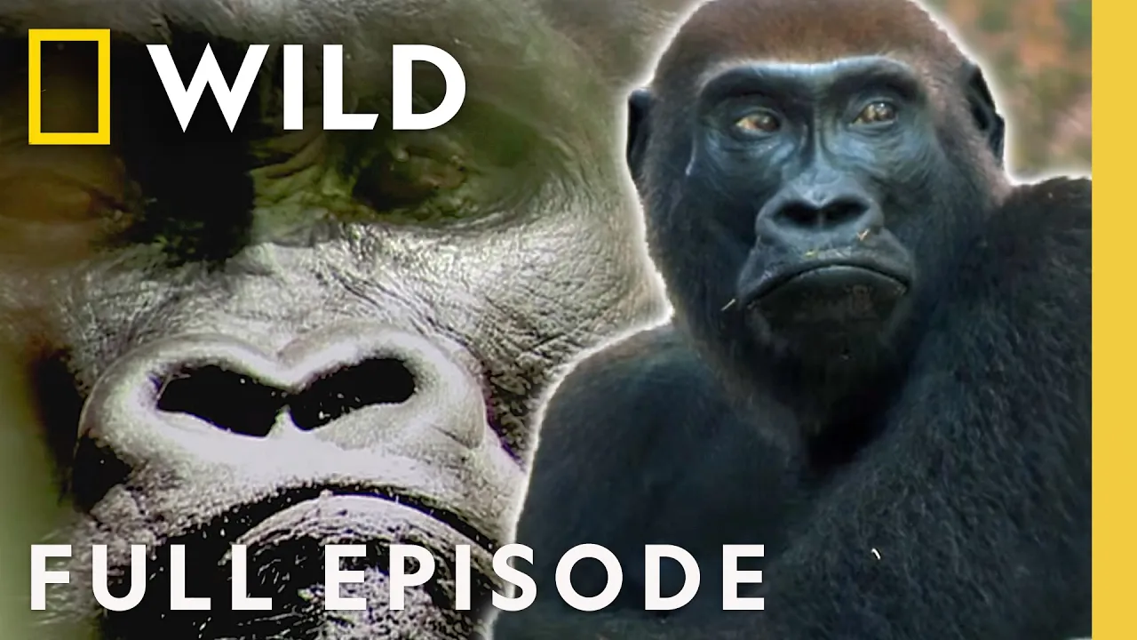


Get daily recaps from
Nat Geo Animals
AI-powered summaries delivered to your inbox. Save hours every week while staying fully informed.