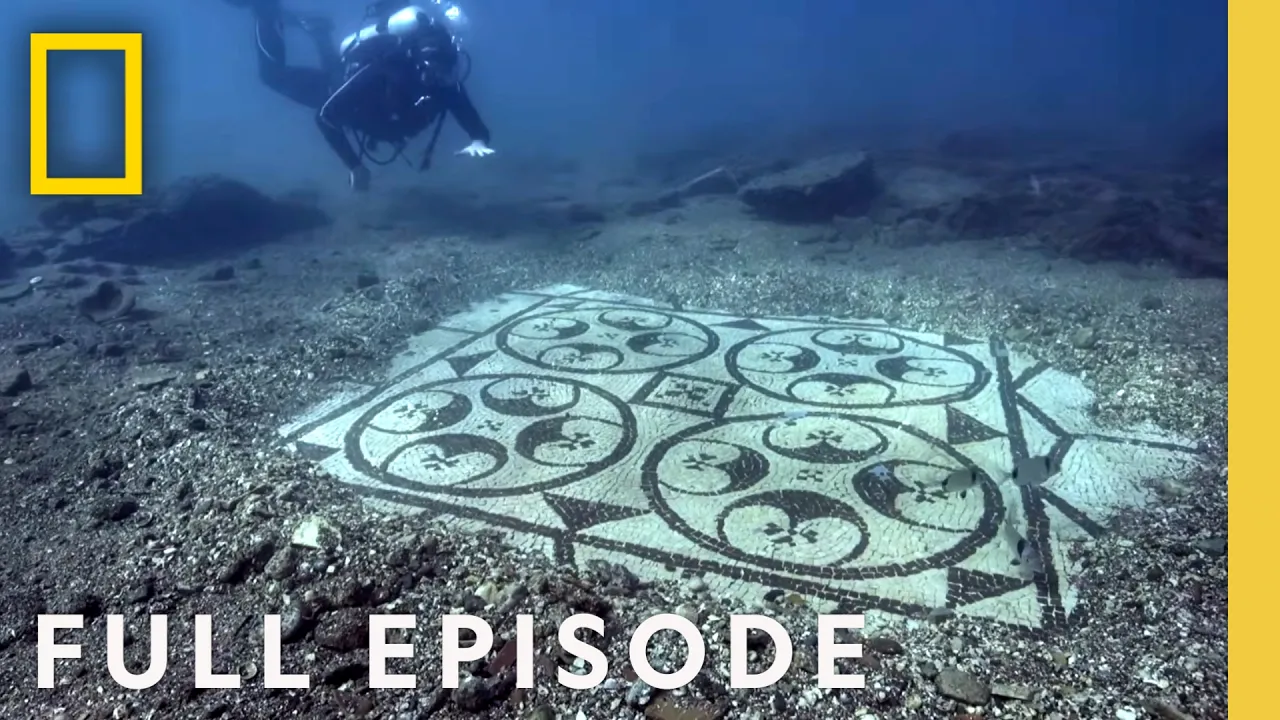
Secrets of the Snake Altar (Full Episode) | Lost Treasures of the Maya | National Geographic
Chapters6
Introduction to LiDAR as a game changing tool that lets researchers see through the jungle like an X ray.
National Geographic's Secrets of the Snake Altar unveils a LiDAR-driven revolution in Maya archaeology, revealing fortified hilltop citadels, vast networks of ramparts, and the Snake Kings’ reach across La Corona to Calakmul.
Summary
National Geographic explorer Albert Lin leads a cinematic tour through a jungle transformed by LiDAR. The Pacunam initiative exposes some 60,000 hidden Maya features, rewriting what we thought about Maya warfare and statecraft. Edwin Roman-Ramirez and Tom Garrison dig where the new map points, uncoverting a mountain fortress near El Zotz and a fortified ridge with watchtowers that suggest a landscape of sustained conflict. Marcello Canuto and La Corona reveal a causeway linking settlements to the Snake Kings, along with a carved altar that ties La Corona to Calakmul’s dynastic network. Across Piedras Negras and Macabilero, drone LiDAR and augmented-reality maps strip away jungle to show walls, ramparts, and a royal court that speaks to a long, brutal war rather than ritualized combat alone. Albert’s journey—from river expeditions to cliffside climbs—highlights how technology is rewriting Maya history in real time. The episode blends danger, discovery, and the painstaking labor of excavation to argue that war and defense were central to Maya geopolitics. The finale leaves viewers with a sense that LiDAR is the most transformative tool archaeology has seen in a century, capable of turning dense jungle into a readable palimpsest of Maya civilizations.
Key Takeaways
- LiDAR mapped over 800 square miles, revealing 60,000 hidden Maya features that reframe our view of Maya urbanism and warfare.
- A mountain fortress near El Zotz, plus ramparts and watchtowers, provides the clearest evidence to date of large-scale Maya defense systems.
- La Corona’s new causeway links to La Corona’s royal courtyard and to Calakmul, suggesting a long-distance, dynastic network for the Snake Kings.
- La Corona’s Snake King altar, dated May 12, 544 AD, ties the site to the Snake Kings’ northern empire and helps connect La Corona to Yo’k’ib’s identity—the turtle lords.
- Drone LiDAR at Piedras Negras unveils a royal court previously hidden under dense jungle, indicating simultaneous political complexity at multiple sites.
- The LiDAR revolution enables archaeologists to move from single-event royal depictions to landscape-scale warfare and defense analyses.
- Field teams are integrating AR platforms to visualize buried structures in real time, accelerating discovery and interpretation.
Who Is This For?
Essential viewing for Maya scholars and field archaeologists, as well as enthusiasts who want to understand how modern tech reshapes ancient history. Viewers curious about how LiDAR and AR change what we know about warfare, politics, and urban planning in the Maya world will find this episode especially illuminating.
Notable Quotes
"Using 'LiDAR' technology that can see through the dense jungle like an X-ray."
—Albert Lin explains the core technology enabling the discoveries.
"This is a fortress, it's a military installation, people are at war."
—Tom Garrison characterizes the El Zotz ridge findings as war-focused fortifications.
"Look at that ridge. Yeah, this is amazing. I mean you can't really say this is anything other than a Maya fortress."
—Observer commentary on the La Corona/El Zotz ridge formations.
"What we think is going on is that for the Snake Kings to do everything they wanted to do in the rest of the Maya world they needed to go through La Corona."
—Marcello Canuto explains the strategic link between La Corona and Calakmul.
"It's lifted. We're holding its weight and we're now just trying to guide it."
—Moment of the ceremonial altar being moved to safety.
Questions This Video Answers
- How did LiDAR change our understanding of Maya warfare and fortifications?
- What is the Pacunam LiDAR initiative and what has it revealed about Maya cities?
- Which Maya sites show evidence of large-scale defense systems and watchtowers?
- How do drone LiDAR and AR tools enhance archaeological fieldwork in dense jungles?
- What is the significance of the Snake Kings in Maya dynastic history?
Maya archaeologyLiDAR surveyingPacunam LiDAR initiativeEl ZotzLa CoronaSnake KingsPiedras NegrasMacabileroAugmented reality in archaeologyMaya warfare
Full Transcript
ALBERT: Okay, here we go. Ready? Let's turn it on. OMAR: Yeah. Wow! Oh, wow. ALBERT: Look at that. That is nuts! What are those? Revealed. From deep within the jungle. Startling evidence of the Maya at war. I'm Albert Lin. Engineer... There's a forgotten world down there. Lost cities hidden in the jungle. And National Geographic explorer. The frontier of the Maya world is actually right under our feet. I'm on a mission to uncover the secrets of one of the world's most mysterious ancient civilizations, the Maya. And right now, technology is writing a whole new story. REPORTER (over TV): New technology reveals that ancient civilization in Central America may have been much more complex than archaeologists believed.
ALBERT: In 2018, National Geographic broke the news of an incredible discovery. (speaking French). ALBERT: That captivated the entire world. And I was right there to see it. Wow! Revealed from the sky. TOM: This is the most important development in Maya archaeology in 100 years. ALBERT: And on the ground. Ah, it gives you like chills up your back. Using 'LiDAR' technology that can see through the dense jungle like an X-ray. Okay. Are you ready to see it without the trees? More than 60,000 man-made structures brought to light in an incredible new treasure map. ARCHAEOLOGIST: Very narrow.
ALBERT: Now, armed with the new map... (speaking Spanish) ALBERT: Some of the world's most intrepid archaeologists... LEILA: It's going to be dangerous. ALBERT: Sure. Are taking on the jungle. FRANCISCO: Bhanny, there is a painted pot. It's got an inscription. ALBERT: In search of its secrets. FRANCISCO: We have a skeleton. ALBERT: All on a quest to rewrite the astonishing story of the Maya. Alright! To me, the Maya have always been one of the most fascinating of all ancient civilizations. But so much of what we thought we knew is wrong. Down there right now history is being completely rewritten.
Armed with this new revolutionary treasure map, archaeologists are on this journey of discovery, but on a massive scale. This time I'm investigating the Maya at war. Unearthing a rare ritual altar... MARCELLO: This is the moment we've been waiting for for about a year. Efraim, Efraim, Efraim! ALBERT: With links to one of the most ruthless of all Maya dynasties. I'll be exploring an ancient site that saw mass conflict. Something went down like right here. Right here people died. And I'll be following one of the most startling of all the new discoveries. EDWIN: Wow! ALBERT: That's completing overturning...
ALBERT: Everything experts thought they knew about warfare... ALBERT: And the ancient Maya. Deep in the jungles of Central America, Guatemalan archaeologist, Edwin Roman-Ramirez is on a mission. Heading for a remote mountain ridge in search of the Maya. ALBERT: The Maya emerged 3,000 years ago in Central America, across a region of what is now Guatemala, Southern Mexico and adjoining countries. The Maya tamed the jungle, creating cities of dazzling scale and complexity. Forging a civilization that lasted over 2,000 years. But as well as stunning glories, there was a brutal side of blood and human sacrifice. But apart from inscriptions and carvings little is known about how they waged war.
Edwin is on the hunt for new evidence, exploring the deep jungle outside an ancient city called El Zotz, in the far north of Guatemala. He's working with fellow archaeologist and National Geographic explorer, Tom Garrison. TOM: I mean this LiDAR data is incredible. You know... ALBERT: On the new high tech map they can see evidence of huge man-made structures. TOM: This looks like we have a pretty serious causeway almost running up the side of the cliff face. ALBERT: Before, these buildings were completely hidden beneath the jungle. Now, they're being laid bare. TOM: I'm thinking maybe if you start down here and climb up, check out what that looks like and then maybe see what this earth work is.
It looks like a pretty big one. ALBERT: Tom and Edwin think the newly identified buildings could reveal some unique clues to Maya warfare. TOM: I mean you look at these features here and, you know, this one's almost eight meters tall. EDWIN: Eight meters, Tom? TOM: Yeah. But, of course, we're not going to know 'til you get out there and check on it. Yeah, this'll be exciting. EDWIN: Okay, that sounds perfect. TOM: Alright. EDWIN: Thank you, Tom. EDWIN: We'll see you later. ALBERT: The new map reveals a mysterious series of buildings, running two and a half miles along a steep ridge, all seemingly connected to a whole complex of structures at its base.
Oppressive heat, dense vegetation and deadly wildlife make this one of the most extreme frontiers in archaeology. ALBERT: It's Edwin's 15th season working in these punishing conditions. ALBERT: But it's the very first time with the new treasure map. ALBERT: Then suddenly out of the dense jungle... ALBERT: Edwin spots something. Perched at the very top of the mountain ridge... an ancient pyramid hidden for centuries. And it seems the pyramid is just one of a group of structures all revealed by new technology. EDWIN: Ooh-hoo, yeah. ALBERT: The new treasure map is the result of a massive survey, charting over 800 square miles of jungle.
Called the Pacunam LiDAR initiative it's bringing together an international consortium of experts. One of the engineers behind the survey is Juan-Carlos Fernandez Diaz. His team flies a plane over the dense jungle canopy. Using high-tech scanning equipment, billions of laser pulses are fired down and bounced back. The technique is called LiDAR. ALBERT: Only a tiny fraction of the pulses make it to the ground. ALBERT: Once all the unwanted pulses reflected from the trees are filtered out, the data that's left allows the engineers to build a 3D map of the hidden jungle floor. San Diego, California. This is where I research using digital technologies to explore the ancient world.
And I've been given very special access... Look at this. To explore the new data on a giant scale. This is how the jungle looks from above. But when LiDAR strips away the trees... countless man-made structures appear. In all, an incredible 60,000 hidden features have been revealed. Two of the project leaders, National Geographic explorers, Tom Garrison and Marcello Canuto have come to join me. LiDAR. MARCELLO: Wow, look at that! TOM: Magic. MARCELLO: Look at that. Look at that. Wow. It's almost like we're flying over the ancient Maya world in a helicopter. This is what is so exciting about LiDAR, it's humbling.
There are things that the LiDAR data is teaching me and teaching all of us. TOM: We're not just talking about one new city, it's dozens. It's a scale of discovery, like you're saying, that it just blows everyone's mind. MARCELLO: When I saw the first LiDAR coming out I said that's the future, you know, that's what we have to do. ALBERT: Back near the ancient Maya city of El Zotz, the new map has led Edwin Roman-Ramirez to a spectacular discovery. On top of this high mountain ridge hides an ancient pyramid. ALBERT: Beyond the pyramid Edwin spots more ruins.
ALBERT: And surrounding them all, giant walls. ALBERT: All predicted by LiDAR. But this new site, with banks and ramparts, looks nothing like a typical Maya city. EDWIN: Look at that. ALBERT: And its discovery could solve a massive mystery about the Maya at war. EDWIN: Wow. This is really amazing. ALBERT: Edwin Roman-Ramirez has followed the new LiDAR treasure map to a startling discovery. The ruins of what Edwin believes was once a vast fortified citadel, protected by the mountain ridge and surrounded by massive ramparts. Which makes it a groundbreaking find. Because in all the Maya world, permanent defenses on such a scale have barely ever been found.
Before the LiDAR map experts believed the Maya settled conflict in a very unusual way. They thought it was highly ritualized, involving only the capture and sacrifice of kings. But now the new evidence suggests something very different. On the giant screen, Edwin's mountain fortress is evidence of war on a colossal scale. Wow. Look at that ridge. TOM: Yeah, this is amazing. I mean you can't really say this is anything other than a Maya fortress. You can see big ditch and rampart systems. The one up there that's eight meters high. So, you know, it's like 25 feet tall.
This is a heavily protected area. Now we're looking west, and as we move up to the next couple of ridges we start to see lone stone structures, and what this could be would be a system of watch-towers, of surveillance. ALBERT: Watchtowers? TOM: See that one right there? ALBERT: Yeah, yeah. TOM: Yeah. They're monitoring this landscape. You see a feature like this and you know that you're looking at a landscape of conflict. This is a fortress, it's a military installation, people are at war. ALBERT: Edwin returns from the fortified ridge, because down on the valley floor there are remains of more buildings.
Here, excavations have already begun. And from one of the first test pits... FERNANDO: Awesome. ALBERT: There's an astonishing discovery. ALBERT: An incredibly rare and perfectly preserved flint spearhead well over 1,000 years old. ALBERT: A deadly spearhead. Fortified ramparts. And a line of watchtowers leave the archaeologists in no doubt. TOM: You're looking at a landscape of conflict. ALBERT: This is compelling evidence of all out war, right at the heart of the Maya world. It's incredible for me to think that all that jungle wilderness down there was once a landscape of fear and of conflict. On a scale that experts had never imagined until the LiDAR survey.
But I want to explore evidence of war for myself. Where I'm headed is so remote the only way in is by helicopter, and then by river. This is the age of discovery, this is what it's all about. Yeah! I'm joining Puerto Rican archaeologist Omar Alcover. Far beyond the Pacunam survey area he's part of a team that is taking remote archaeology to a whole new level. Are we in no-man's land right now, what is this? OMAR: We're basically in international waters. The river's shared by both Mexico and Guatemala, and it's one of the natural borders between the two countries.
ALBERT: 2,000 years ago these banks were home to two rival Maya kingdoms. An ancient Maya city called Piedras Negras. And Macabilero, a nearby group of barely-explored ruins. At both sites, cutting edge technology is revealing more startling evidence The sun's now making its way right overhead and the temperatures have picked up. So it's going to be a challenge. I'm going up a little bit more bionic than most. But it's worth it. This jungle has secrets to reveal and we're going to find them right now. ALBERT: I'm climbing through isolated mountain jungle with For the Maya this would have been just as tough.
This is some of the densest jungle I've ever been. I mean it's old growth, you know. You can't see more than 50 or a 100 feet in any direction, then it's just green. The challenge is trying to find anything in all this. Luckily for us, we've got technology. Ready, let's turn it on. ALBERT: Wow. OMAR: Oh, wow. Nice. Yeah. That is nuts. Is that just all masonry? I've built data gathered by Omar into an augmented reality platform. And suddenly I can strip away the trees revealing a vast wall stretching over 100 yards across the hillside.
It's like an x-ray right through the trees, huh? That is crazy. Let's go check it out. OMAR: Yeah, let's go. ALBERT: It's amazing to think each one of these blocks would have been cut and hauled up here by hand. But until Omar combined thousands of close-up photographs into a single model it was impossible to see the entire line of the wall from a distance. And what it reveals is the incredible effort made by the Maya here to defend themselves from attack. OMAR: The fact that they built over seven of these on the top of a mountain means the threat of a violent encounter was very real.
ALBERT: Something went down like right here, right here people died. OMAR: Yeah, probably, probably. ALBERT: You're running up, you're trying to attack, you're running up, you hit these bricks and then all of a sudden... OMAR: They come at you with sling stones or just loose rocks even that they throw down. ALBERT: This is another fortress built by a community under threat over 2,000 years ago, right at the extremes Along with Edwin's citadel near El Zotz, these discoveries are changing our whole understanding of Maya warfare. It's been a really hard day, really hard. But there's a lot more to see in this whole jungle, and it's just going to have to wait until tomorrow.
64 miles east of Omar's fortress and back inside the LiDAR survey area it's morning, and here they've got better weather. That's good news for archaeologist Marcella Canuto. He's on a mission to explore another totally new discovery revealed by the LiDAR map. MARCELLO: The site is relatively large. You know, you can see several buildings, one, two, three, four, five, and there's sort of maybe three buildings here and perhaps a little platform. So it's a relatively substantial site. ALBERT: Marcello has spent more than a decade investigating an ancient Maya site called La Corona. It's his first field season since the results of the Pacunam survey.
And on this giant screen Marcello is going to see La Corona as he's never seen it before. So hidden inside these trees... MARCELLO: Yeah. ALBERT: Is the site of La Corona. MARCELLO: Yes. So nestled in amongst all of these swamps and hidden under those trees is the main part of La Corona right there. ALBERT: Let's take a look, ready? Wow, look at that. That looks great. Look at that, look at that, wow. ALBERT: That's your site. MARCELLO: That's it, that's it. That's it. MARCELLO: Yeah, that is so cool to see. ALBERT: It just all of a sudden pops out of the trees.
MARCELLO: Yes, exactly. ALBERT: How long have you been working here? MARCELLO: We have been working here since 2005. ALBERT: 2005. MARCELLO: 2005. ALBERT: And then only this year you see this LiDAR data. This is the first time we're actually seeing the entire site in one shot. ALBERT: No-one knows La Corona better than Marcello. But the LiDAR map is even surprising him. MARCELLO: Look at that, okay. There is a causeway that I had not seen before right there, coming through that central group, right there. See those two little parallel lines. ALBERT: Oh, yeah, I see they sort of run together...
MARCELLO: That's right. That's right. And what it's doing is it's actually... Oh, that's amazing. And that causeway is connecting up to another group that we've never investigated before. ALBERT: Did you know about this before? MARCELLO: No, no, I did not know about this at all. I really did not know about this. Until I saw this data I had never seen that causeway before. ALBERT: And it's not the only discovery revealed by the LiDAR. Further, beyond the new causeway there's another previously unknown site. Heading into the field outside La Corona, Marcello investigates. MARCELLO: This is it.
ALBERT: Before the LiDAR survey, Marcello would never have found anything hidden in this jungle. MARCELLO: Oh, yeah, yeah. ALBERT: But right on cue. MARCELLO: There it is! MARCELLO: There's the main structure. How cool is this? Yep, this is the big one. This is the main structure. ALBERT: The LiDAR map has led Marcello to some ancient remains completely new to archaeology. MARCELLO: And there's the other one, there's the other one. These are the two main structures in the site that we were looking for. ALBERT: It's a massive find. An entire settlement less than a day's march north of La Corona.
Future excavations will seek to reveal more about this site and La Corona itself. MARCELLO: In the simplest way possible we found a new site today, that's a good day. That's a really good day. ALBERT: Back at the main site in La Corona excavations have been underway for over a decade, and it still continues to yield treasures. MARCELLO: Working in a place like La Corona is almost a full time job. So after 12 years it becomes just part of your life. So of course it holds that kind of special place for all of us, because this is something that we've dedicated our professional lives to.
ALBERT: One of the biggest finds of all is being dug from the ground this season. A lavishly carved stone monument. Marcello made the discovery beneath a collapsed temple in one of La Corona's grand plazas of the ancient city. Carvings on the monument contain clues to one of the most powerful royal dynasties the Maya ever knew. The Snake Kings. For over a century experts have worked to decode Maya writing, and much of it still remains a mystery. But they have been able to decipher the story of the Snake Kings, who rose in the north and conquered city after city, including La Corona.
Morning, the beginning of a crucial day at La Corona. Marcello and his team are preparing to lift the precious monument and transport it to safety, at Guatemala's National Museum of Archaeology. Its shape and location leave the team in no doubt that this is a sacred ritual altar. MARCELLO: We have evidence on the very surface of this altar of some burning, some kind of ritual that involves fire. The kinds of rituals that were involved here are difficult to imagine. Rituals that in other sites involve burning would have involved some form of blood-letting. ALBERT: Torture and death were fundamental to Maya belief.
On sacred altars ceremonies would be held to appease the gods with human sacrifice. Alejandro Gonzalez began excavating the altar over a year ago. MARCELLO: So right now we're finally setting up the scaffolding that's going to be required to lift the altar. ALBERT: Made from solid limestone, it's twice the weight of a grand piano. So we'll see how this works. So this is it. MARCELLO: Minutes ago like the whole altar slightly moved, and I was thinking to myself, you know, that's the first time this altar has moved in the last 1500 years. Everything is starting to tense up, both my nerves as well as the ropes.
ALBERT: For archaeologists it's the altar's inscriptions that are most important, with clues to the epic rise of the Maya Snake Kings hidden in its delicate and intricate carvings. The altar depicts a powerful King of La Corona and it reveals his name, Chak Took Ich'aak, a known ally of the Snake Kings. And a longer inscription even tells us when it was dedicated, May 12th 544 AD. Until this discovery, no-one knew that the powerful Chak Took Ich'aak had anything to do with La Corona at all. But the altar's Snake King inscriptions fit with the new discoveries revealed in the LiDAR map.
MARCELLO: From La Corona this is exactly in the direction that one would walk to go to Calakmul, the capital of the Snake Kings. ALBERT: It turns out that Marcello's newly revealed causeway and settlements went directly to the Snake's capital city, far to the north. MARCELLO: What we think is going on is that for the Snake Kings to do everything they wanted to do in the rest of the Maya world they needed to go through La Corona. (speaking Spanish). ALBERT: Back in La Corona's ancient plaza, have been working in scorching heat for eight hours, gradually inching the altar from the ground.
MARCELLO: It's lifted. We're holding its weight and we're now just trying to guide it. ALBERT: Time is running out. MARCELLO: It's going to be our last shot because we're going to lose the light in about half an hour, in less than an hour we'll lose the light for sure. ALBERT: After more than a 1,000 years in the ground the precious altar hangs precariously in the air. (shouting) MARCELLO: Efraim, Efraim, Efraim, Efraim. ALBERT: The point of no return. A ton of ancient Maya altar is hanging from a fragile jungle scaffold. Night is fast approaching and the altar is still not safe.
MARCELLO: Oh, my god, it's on the truck. -It's on the truck. MARCELLO: It's on the truck. I'm never finding another monument in my life! ALBERT: At last they've done it. MARCELLO: I'm ecstatic, I'm exhausted, but I'm ecstatic. ALBERT: Back on Guatemala's border with Mexico the rain's finally cleared and I'm with archaeologist Omar Alcover on the trail of another ancient city. We just made it another 10 miles down the river in this wilderness, this thick, deep jungle. And we're now at one of the most important archaeological sites in all of the Maya world, and yet we're still in the most remote part of the Guatemalan jungle.
I've already explored a mighty fortress at Macabilero, now I'm heading for an ancient city called Piedras Negras. survey area, Omar is a part of a team using a new technology that could be another game changer in archaeology. Here they've been doing LiDAR using drones. It's more flexible than using conventional aircraft, and much more affordable. Right now this technology is experimental, but the potential is massive. The trees are so thick here. ALBERT: I've built the very first data map of Piedras Negras into my augmented reality platform, and I'm hoping it will let me see through this dense jungle.
Trees... no trees. That is awesome. Wow. ALBERT: So that's a building? ALBERT: Whoa, look at that. What is that? OMAR: Yeah, that's a pyramid. ALBERT: That is so awesome, it's like a window into the past. This is incredible. I mean this is just... It's almost like magic, you know, all of a sudden you can just delete the trees and there you go. For the very first time, thanks to drone LiDAR, I can see the ancient remains of what were once the giant pyramids of a lavish royal court. Excavations are even helping to predict how many of the buildings might have looked.
They're so different from the first fortress at Macabilero. Omar's in no doubt, this royal court was built by a different group of Maya people. And he believes that the two groups were at war. Did something happen between here and Macabilero? OMAR: Yeah. I mean Macabilero gets abandoned, but Piedras Negras rose, not only in power, but in population and size immediately after Macabilero was abandoned. ALBERT: So something must have gone down? OMAR: Mmhmm. ALBERT: It's intriguing to think that 2,000 years ago this lavish royal court of Piedras Negras could have been at war with the nearby settlement of Macabilero.
And Omar believes that conflict might have continued for more than 600 years, until around 350 AD, when the fortress of Macabilero fell and its settlement was abandoned. Piedras Negras was victorious and flourished into a mighty Maya kingdom. OMAR: Its name in ancient Mayan... ALBERT: Would have been what? OMAR: Would have been Yo'k'ib. ALBERT: Yo'k'ib. What does that mean? OMAR: It's like the home of the turtle lords. ALBERT: The turtle lords? So that's how the royal court identified themselves, as the turtle lords. ALBERT: We're standing on the hallowed grounds of the ancient turtle lords right now?
ALBERT: With a window into their world. In Maya mythology, turtles were important. Their shells were associated with earth gods and represented the cracked soil that crops grew from. The turtle lord of Piedras Negras were the self-styled lords of the life-giving earth itself. Oh, look at this, this is an actual room, huh? OMAR: Yeah, so this is the entrance to one of them. Exploring the grand royal court of Piedras Negras I can still sense their power. Look at these massive stairs and these terraced mounds. You're basically looking at the blood, sweat and tears of hundreds and hundreds of people over many generations.
OMAR: Yeah, so that's what basically highlights the power these Kings had, able to mobilize all of the resources and people that would have been necessary to build a space like this. It really accentuates the power of the turtle lords here. ALBERT: And now, after centuries of decay, modern archaeology and cutting-edge LiDAR from drones can fully reveal this incredible ancient palace for the very first time. Before LiDAR most of what we knew of Maya war came from drawings depicting ritual conflict and the capture of kings. But now that's completely changing. Revealed by new technology... ALBERT: A fortified citadel at the heart of the Maya world, with ramparts, watch-towers, and even the incredibly rare evidence of a weapon of war.
EDWIN: That's a really cool find. ALBERT: A ritual altar connecting the city of La Corona to the powerful warring dynasty of the Snake Kings. MARCELLO: That's the first time this altar has moved in the last 1500 years. ALBERT: And a settlement pointing towards their capital far to the north. MARCELLO: There it is. There's the main structure. ALBERT: All newly discovered evidence of conflict being made by technology. TOM: It's a much more sophisticated idea of conflict and war than you think of when you see pictures of Maya Kings capturing a single person by the hair in battle, you know.
That's a single event. MARCELLO: This tells you this is not small scale. These are, this is a landscape that is riddled with conflict and was for centuries, and this is something that we would never have been able to tell without the LiDAR. ALBERT: With tens of thousands of new LiDAR discoveries still waiting to be explored... TOM: It's incredible. It's a revolution in our field. It is changing the way that we do Maya archaeology. ALBERT: The jungles of Central America can only have more secrets to give up. TOM: We're definitely talking about a period that is pre-LiDAR and post-LiDAR in Maya archaeology, and everything that we know now is going to be different from what we knew before.
It's that big of a change. ALBERT: It almost feels like the invention of the CAT scan or the x-ray, but for archaeology. From high in the sky to beneath the trees, into the very depths of the Maya world, archaeologists are still just beginning to reveal the extraordinary world of one of our planet's greatest ancient civilizations, the mysterious jungle kingdoms of the Maya.
More from National Geographic


Get daily recaps from
National Geographic
AI-powered summaries delivered to your inbox. Save hours every week while staying fully informed.